Notice: Undefined index: id in /home/ft4user/foreststreesagroforestry.org/wp-content/themes/FTA/template-parts/content.php on line 3
  • Home
  • Sentinels of Social Transformation in Borneo

Sentinels of Social Transformation in Borneo


Notice: Undefined variable: id_overview in /home/ft4user/foreststreesagroforestry.org/wp-content/themes/FTA/template-parts/content.php on line 64
A bird view of a typical swidden landscape in Batang Lupar (Yves Laumonier/CIFOR)
Posted by

FTA communications

We often think about man’s effect on the environment nowadays. We rarely stop to think about man’s effect on man.

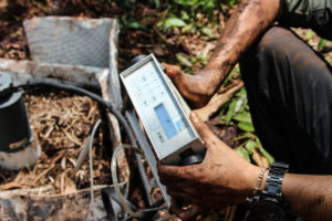
Tracking the state of the world’s forests over the decades is, of course, extremely important, but what about the forest communities – are they also flourishing? Indeed, you could make a case that any forest hosting an impoverished community is a forest that, however flourishing today, tomorrow is destined for the ax. That is why, when an international team of social and environmental scientists got together to create a long term tropical forest monitoring project, they made sure to give it two arms of equal strength, the better to collect both environmental biophysical data and human socio-economic data.

By combining these two seams of data, researchers and policymakers are able to make long range predictions about effects in both directions. That is why this ambitious project is called Sentinel Landscapes.

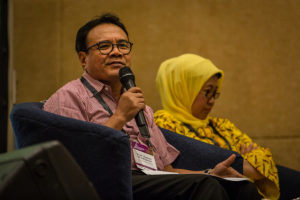
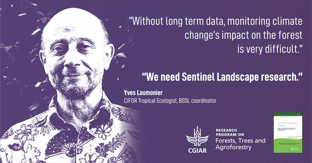
Yves Laumonier, senior scientist at the Center for International Forestry Research, explains: “The Sentinel Landscapes are a long term research network to monitor not only biophysical data, but also social transformation in the landscape, especially for the livelihood of indigenous people and people who are still dependent on the forest.”

FTA Sentinel Landscape Global Sites

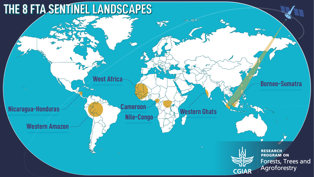
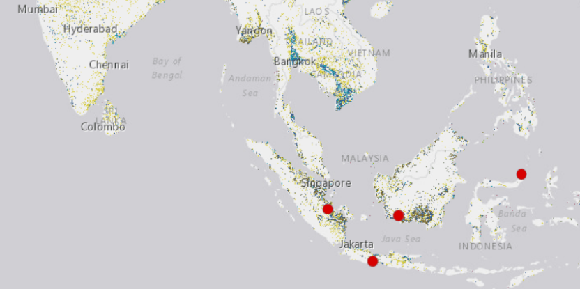
The Forests, Trees and Agroforestry (FTA) research program of the CGIAR, led by the Center for International Forestry Research (CIFOR), has selected eight Sentinel Landscape research sites across the tropics, each site carefully chosen to represent different positions on the forest transition curve.

Forest Transition Curve – HLPE (2017), adapted from CIFOR (2011)

The forest transition curve describes how pristine primary forest is gradually cleared for timber, agriculture or development and how, at a certain point, this deforestation peaks and is replaced by the regrowth of secondary forest, planting of agroforestry or timber, leading to a degree of environmental recovery in the landscape.

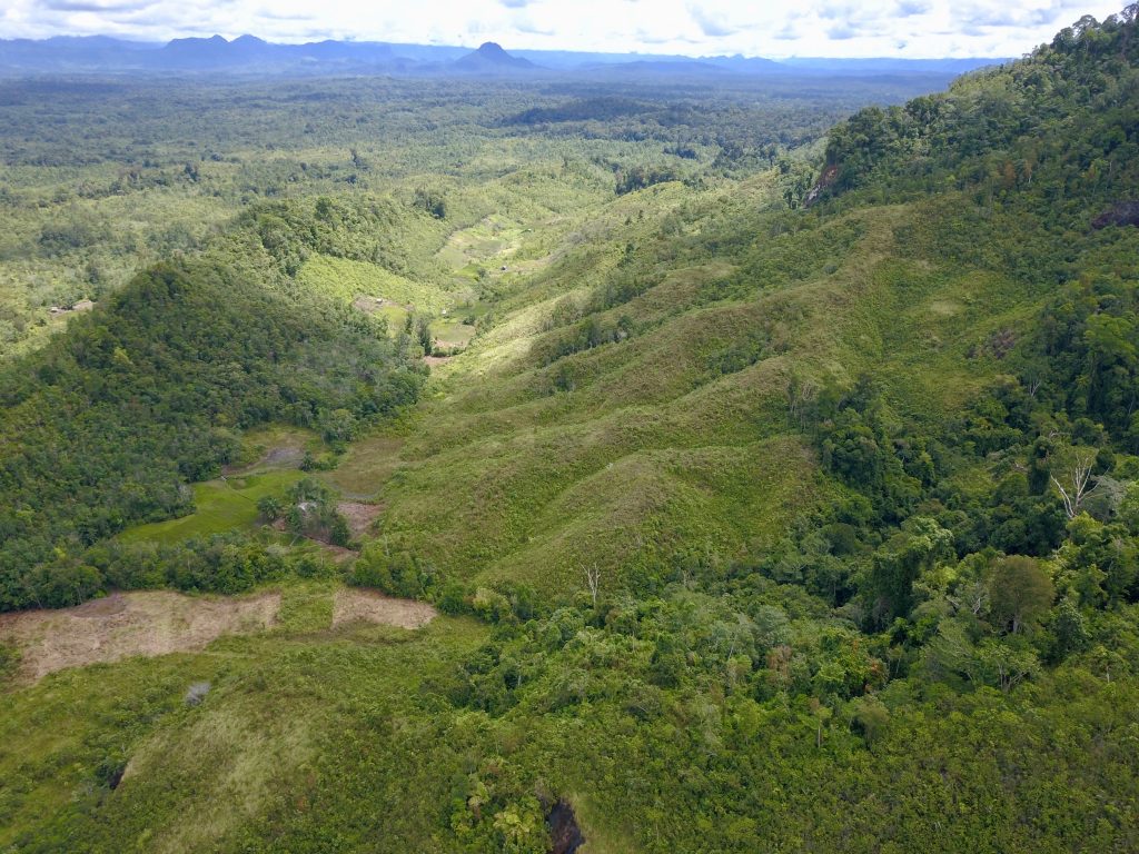
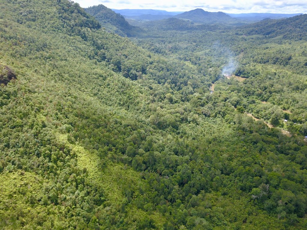
With significant areas of standing ancient forest, the Heart of Borneo is perched at the top of the curve. But even here, crawling over the horizon, we see the tracks of bulldozers.

In Sentinel Solutions for the Anthropocene, we explored how long-term biophysical monitoring is a “global health check” for the tropics and how, in the Nicaragua-Honduras Sentinel Landscape, that data is being used to track forest degradation and climate change.

In this long read, we turn our attention to Borneo and look at how the different socio-economic contexts revealed by the Sentinel Landscape project affect forest conservation in one of the last forest frontiers.

Borneo: The Last Forest Frontier

The Borneo-Sumatra Sentinel Landscape report [download it in pdf here]
The Borneo-Sumatra Sentinel Landscape (BSSL) unfolds over four sites on two of Indonesia’s largest islands, from the almost pristine forests of Kapuas Hulu on Borneo to the more developed plantations of rubber and oil palm on Sumatra.

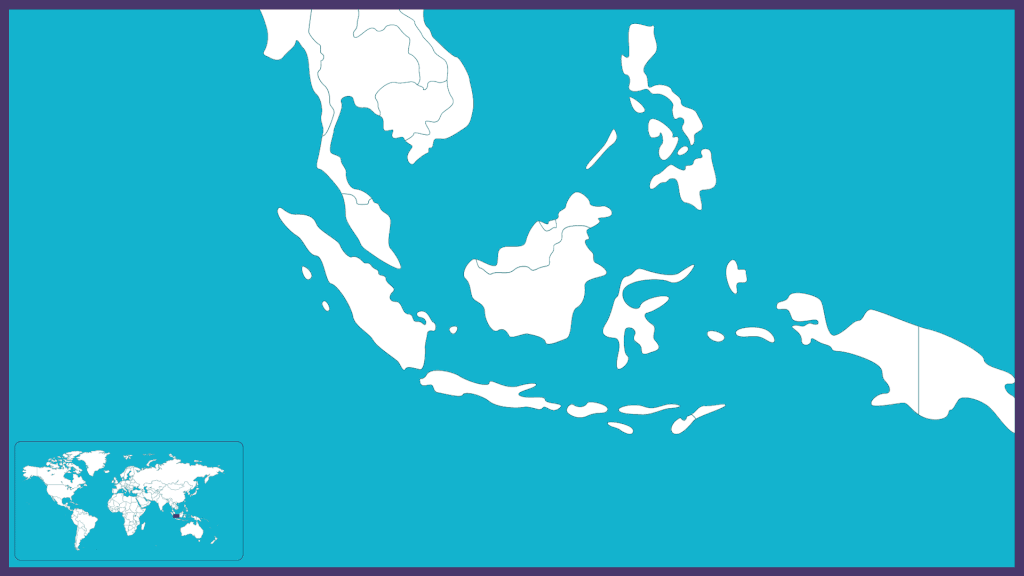
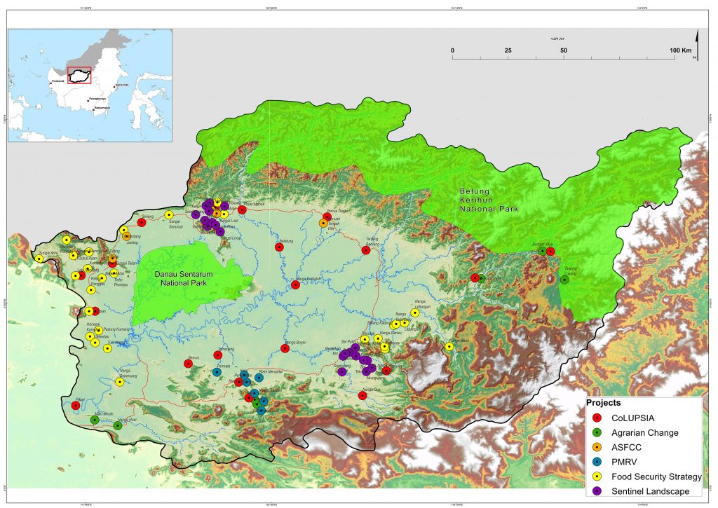
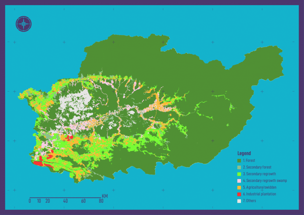
The recently published BSSL report focuses on two study blocks in the Kapuas Hulu Regency of West Kalimantan on Borneo. Straddling the equator, Borneo is the third largest island in the world, more than three times larger than Great Britain and seven times the size of Cuba. With 73 percent forest cover and two national parks, the report describes Kapuas Hulu as part of the “last forest frontier”.


READ MORE: The first Sentinel Landscape stocktaking pilot study: Report Nicaragua-Honduras


The four BSSL sites

Yves Laumonier is lead author of the BSSL report. “We have other sites in Indonesia that are much more transformed or degraded,” he explains, “but we can imagine that Borneo shows the original state of the forest.”

Batang Lupar, Borneo: Aerial view of the Danau Sentarum National Park wetlands, a unique ecosystem of interconnecting seasonal lakes, peat swamps, and periodically inundated freshwater swamp forests. (Yves Laumonier/CIFOR)

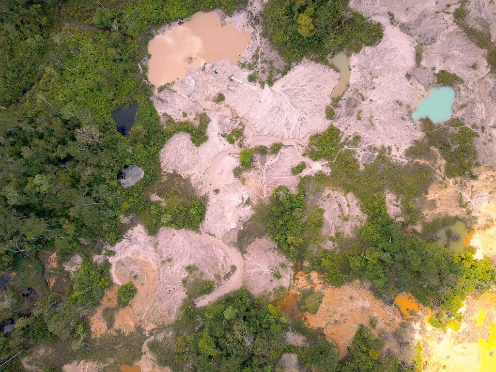
However, Laumonier also warns that oil palm plantations are expanding near the biodiversity corridor between the two national parks, creating both economic opportunities and conflicts.

Degraded swidden landscapes on steep slopes and poor soils in Mentebah, Borneo: Improved road infrastructure has brought a different context for the mostly Malayu population. Gold mining is an important source of income and, although the area is more “developed”, inequality is also higher than in the villages of Batang Lupar. (Yves Laumonier/CIFOR)

Lost without water

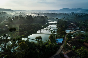
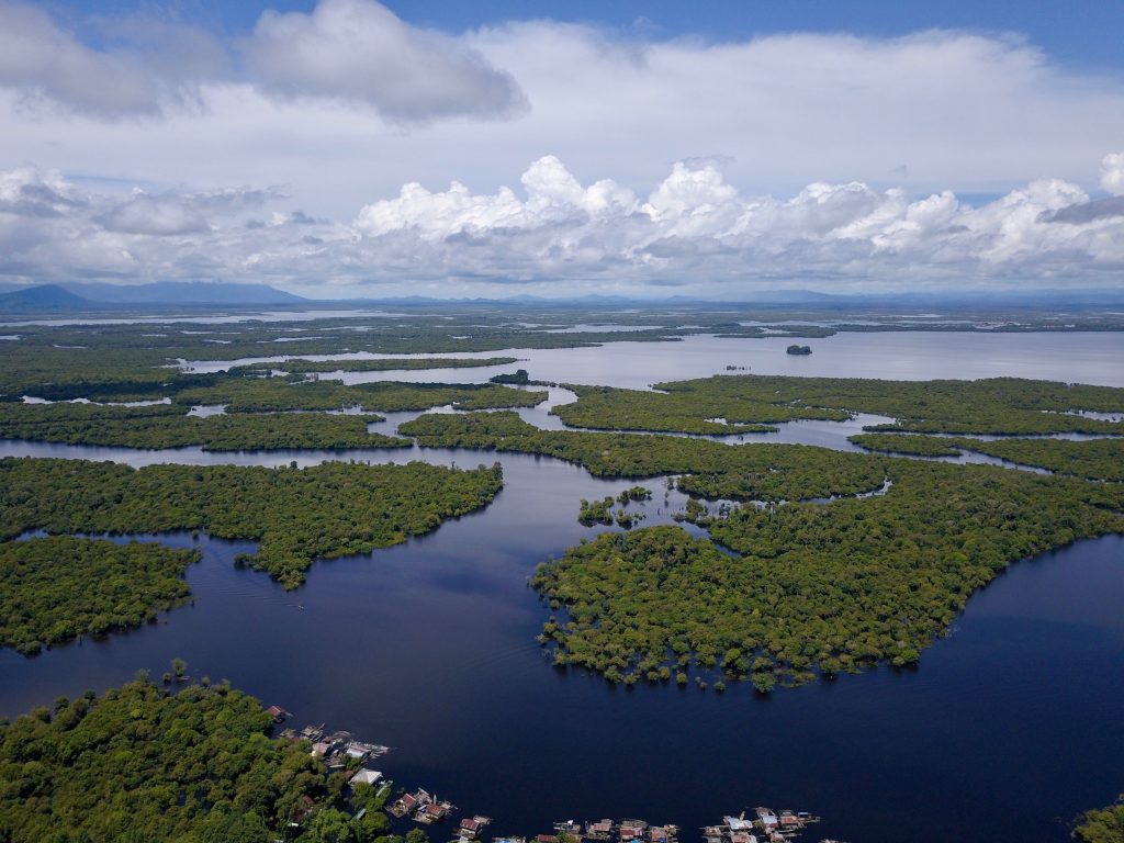
Between the two study blocks, Batang Lupar in the north and Mentebah in the south, lies the Danau Sentarum National Park: “a unique wetlands system with many lakes and swamp forests,” according to Laumonier. “Water fluctuation can be ten metres,” he continues. “During the rainy season some trees are underwater!”

The two sites were specifically chosen for their position as sentinels of the wetlands. As the report states: “Any transformation of these landscapes may have an impact on the integrity of the wetland ecosystem and on the communities living there.” This is significant because the wetlands are fed by the Kapuas River, the longest in Indonesia, sprawling over an area bigger than the countries of Costa Rica and Denmark put together.

The river is ecologically important, teeming with a rich diversity of fish, flora and fauna from the dense mountain rainforests to the alluvial delta where the Kapuas is swallowed by the South China Sea. But it is no less essential to human existence: a livelihood for fishermen and farmers, a shipping superhighway for passengers and freight, and a water reservoir that nourishes the whole of West Kalimantan province.

Indeed, the significance of the river to the people of Kapuas Hulu is not restricted to its magnitude, diversity or even the yield of its fruits. The indigenous Iban Dayak don’t navigate by the cardinal points – north, south, east or west – they navigate by reference to the natural world – uphill, downhill, upstream or downstream. The Iban are quite literally lost without water.

“We need this research”

Long term ecological monitoring projects aren’t new, but Sentinel Landscapes are the first to attempt such an undertaking in the tropics. “In Europe you have the Pan European Ecological Network, a large network of long term ecological research,” Laumonier says. “There is also something similar in the US. But in the tropics, it’s not existing.”

Given that tropical forests account for approximately half of the planet’s aboveground carbon and its critical importance for conserving the planet’s biodiversity, this is surprising, to say the least. “The key for me is to focus on the tropical belt,” Laumonier says. “We need this research. If you want to monitor climate change impact on the forest, and you don’t have long term data, it’s very difficult.”

However, long term monitoring projects in the tropics are not as straightforward as in the highly industrialized environments of Europe and North America. “Many ecological science methods used in Europe are not suitable for the tropics,” Laumonier says. “The tropics have the highest ecological biodiversity, and this makes monitoring much more complex than in Europe.”

Research in remote, pristine forests

It’s not only the scientific methods that need to be rewritten for the context. The practicalities of on site research are complicated too. “Pristine forests are only found nowadays in very remote areas that are difficult to access,” Laumonier says. “This is a burden on research. In Europe, you simply get in your car and go there.”

Even when the researchers reached the remote villages of Kapuas Hulu, that wasn’t the end of their challenges.

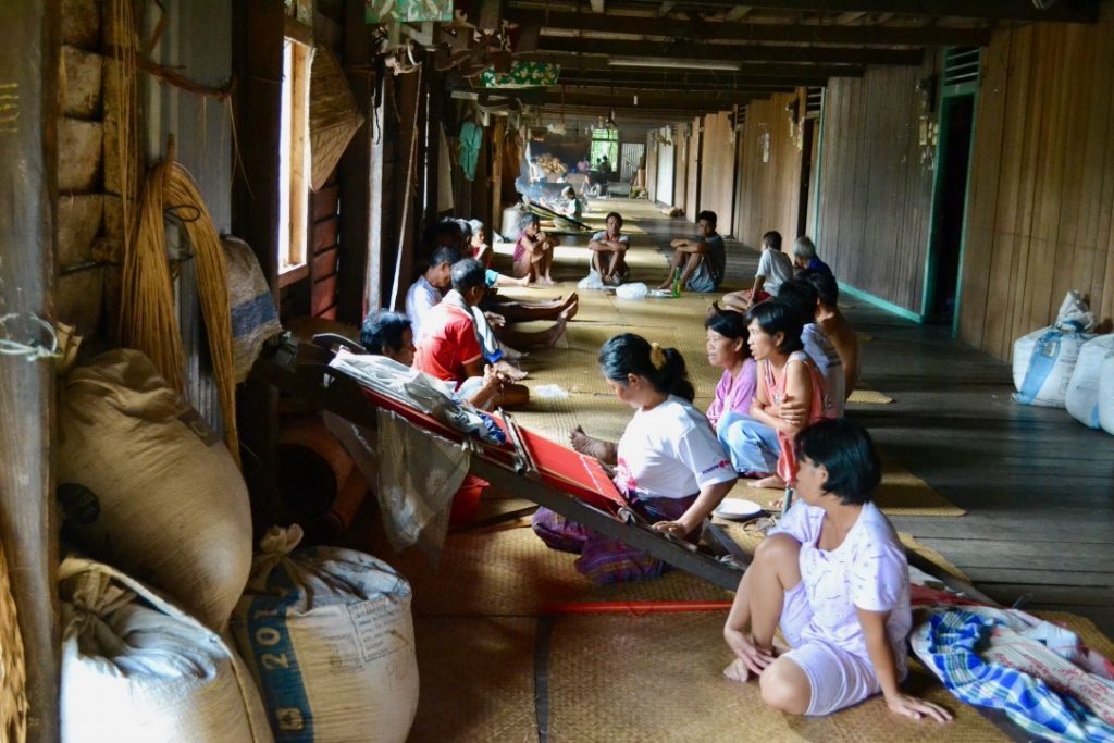
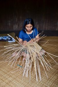
Alfa Simarangkir is a private consultant who helped collect the data from the socio-economic household surveys. “It took a long time to do the interviews in Batang Lupar especially,” she says. “Not many people speak Bahasa and they had difficulty understanding what we wanted to do.” Indeed, the BSSL report notes that, without a local partner who spoke the Iban dialect, the survey would have been impossible.

As well as the language barrier, Simarangkir and the rest of the team ran into trouble collecting even the most basic data, like the size of household land plots or what year a particular farm was opened. “We tend to use hectares, but in Batang Lupar they have their own local units and you can’t necessarily compare one unit with their neighbour’s,” Simarangkir says. “They also have difficulties remembering the precise timing of events. They don’t have that way of thinking. It took us one week to survey ten households!”

With 139 households to survey in Batang Lupar and another 300 in Mentebah, the socio-economic element of the Sentinel Landscape research was a heroic undertaking that compensated Laumonier, Simarangkir and their team with fascinating revelations.

FTA Socio-economic surveys in Kapuas Hulu

The Iban Dayak of Batang Lupar: from headhunting to oil palm

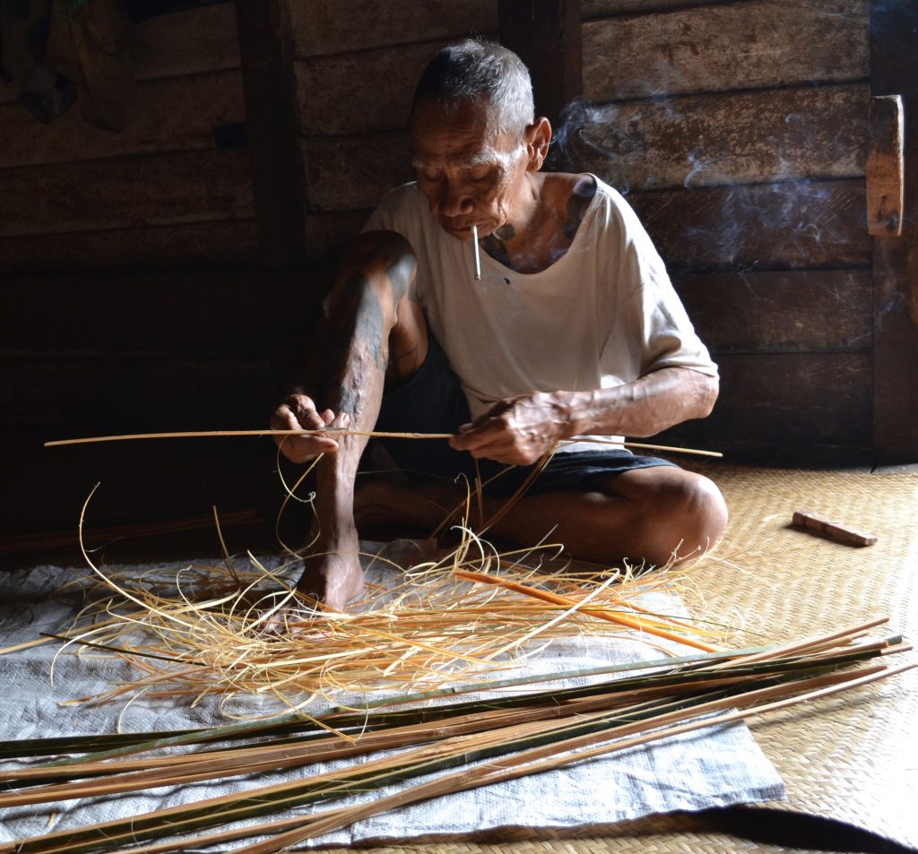
“Borneo is one of the most forested of the Sentinel Landscape sites, so it’s a bit special,” Laumonier says. “But the local community of Batang Lupar are also quite special: the Iban Dayak.” The Iban are renowned as ferocious warriors, notorious for severing the heads of their enemies, smoking them over a fire and keeping them as grisly mementos – a practice, thankfully, long since ended.

They do still live in traditional longhouses, however. “These longhouses are not isolated individual houses, they are connected apartments, originally to protect themselves from the enemy,” Laumonier explains. “The shared longhouses mean that cohesion in the group is very high.”

Late afternoon gathering in a longhouse in Batang Lupar (Alfa Simarangkir/CIFOR)

The Iban, at least in Batang Lupar, also still live lives that “depend on the forest”, according to Laumonier. They practice swidden agriculture (also known as slash-and-burn or fire-fallow), clearing land for cultivation by cutting and burning the existing vegetation – mostly old fallows rather than primary forest.

But with intense international scrutiny of the annual Indonesian forest fires, this traditional farming method has become problematic. “To avoid excessive haze in the region, the Iban ancestral technique of using fire to clear their fields has recently been forbidden,” Laumonier says. “But the big fires you see in the news are never caused by the indigenous people: they know very well how to control their fires. The big fires you see every dry season are caused by the big industrial companies.”

Kapuas Hulu vegetation maps 2000-2010-2019

Laumonier argues that the ban on swidden agriculture is based on an outdated theory of conservation. “In the 1980s, many governments and even conservationists wanted to get rid of agriculture in the forests,” he explains, “but now a lot of people think it’s not that bad, especially for biodiversity.”

“After one or two years of cultivation, the Iban leave the land fallow for regeneration,” Laumonier continues. “If the cycle is not too short – 10 or 15 years – the secondary forest has recovered and biodiversity is already very high.”

The light environmental touch of this traditional practice has a modern downside. “These people are living in subsistence,” Laumonier says. As development spreads even into the furthest reaches of Kapuas Hulu, traditional ways of living are being eroded by the temptation to cash in on the forest.

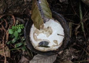
“The Iban plant rubber as a cash crop, but unfortunately the market price is very low and they can be tempted to shift to oil palm,” Laumonier says. “The oil palm companies are advancing little by little, sometimes with conflict, sometimes not,” he adds. “Many Iban are resisting the oil palm and in the peat swamps there’s a government-imposed moratorium on clearing – but it still happens.”

Mentebah: the road, the rubber and the gold

Batang Lupar and Mentebah are only 100km apart, but the local inhabitants could hardly live in more different situations.

Aerial view of gold mining impact on landscapes in Mentebah (Alfa Simarangkir/CIFOR)

“The tendency of some research is to work in one village and draw conclusions for whole region,” Laumonier says. “The advantage of the Sentinel Landscapes is that we get representative data for the larger region, such as districts.”

The most striking geographical difference between Batang Lupar and Mentebah districts is that, where Batang Lupar is relatively remote and hard to access, Mentebah lies on the main road between Sintang and the administrative capital of Kapuas Hulu, Putussibau. From this simple detail comes a cascade of socio-economic differences between the two sites. As Simarangkir says of Mentebah: “There is a really different way of living there. The road has given a huge opportunity to them.”

Secondary forests in Mentebah (Yves Laumonier/CIFOR)

The road has also brought outsiders to the district. “In Mentebah, people from Java are given land by the government,” Simarangkir says. “The population is diverse compared to Batang Lupar.”

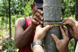
Simarangkir explains that the families in Batang Lupar depend more on natural resources, while those in Mentebah largely earn their living from other employment opportunities. In particular: tapping for rubber and mining for gold.

Traditional gold mining activity in Mentebah – this activity havs desastrous effects on the riparian forest and the quality of the river water (Yves Laumonier/CIFOR)

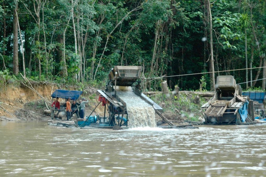
“The gold mining is illegal,” Simarangkir says. “When one of the respondents showed me some gold he had already made into a block, he told me that he would be in serious trouble with the police if they caught him.”

Despite the potentially lucrative gold industries, the socio-economic survey also discovered that there was significantly greater food insecurity in Mentebah, and that inequality was more extreme between the haves and the have-nots.

The curse of capitalism?

“In Mentebah you need money to buy your daily needs,” Simarangkir explains, “but in Batang Lupar I think they are lucky. They grow vegetables. If they need fish, they go to the river. If they need meat, the men go hunting. You don’t need money to buy food in Batang Lupar.”

Iban man working on traditional Bemban basketry (Alfa Simarangkir/CIFOR)

The road is both a blessing and a curse for the people of Mentebah, as access to the markets of Sintang and Putussibau draws farmers away from their fields to the cash crops.

“Not many people in Mentebah concentrate on the productive landscape any more,” Simarangkir says. “Most of them work more on rubber plantations – but the rubber price fluctuates.” Without the guarantee of a stable price for rubber, a family’s fortunes in Mentebah can collapse from one year to the next in a way that the diversified subsistence farming of Batang Lupar would not.

The financial lure of rubber and gold means that the fields of Mentebah are less productive too. “In Mentebah, people might not have the time and labour to open fields because they are gold mining instead,” Simarangkir says. “In Batang Lupar they stay in the villages and have time to work in the fields.”

Despite their rice paddies, Simarangkir found that most households in Mentebah still have to buy rice. “They cannot predict the harvest,” she explains. “In Batang Lupar, one household can own many different land plots and they can rotate their crops. But in Mentebah they don’t rotate at all because they don’t have as much land. This is one reason why the harvest in Mentebah is not so good: you need to give time for the land to recover.”

Another striking difference between the two districts is that women own significantly more land in Batang Lupar than in Mentebah.

The women landowners of Batang Lupar

The BSSL socio-economic survey found the women owned nearly a third of all land plots in Batang Lupar, whereas women in Mentebah owned less than a fifth. Again, the road, rubber and gold of Mentebah offer clues to why this might be.

Iban woman working on traditional Bemban basketry (Alfa Simarangkir/CIFOR)

“Many of the women in the Batang Lupar come from the nearest village. In Mentebah, women come from cities all over Indonesia,” Simarangkir explains. This break in communal continuity and in the line of inheritance is one reason why women might own more land in Batang Lupar.

But Simarangkir speculates further: “I’m thinking that much of the land previously owned by women in Mentebah has already been sold because households can’t rely on unstable farm products like rubber,” she says. “Instead they rely on illegal gold mining. Sometimes they get a lot of money, but if not then they have to sell whatever they can – including, perhaps, their land.”

“There is a really different way of living there,” she says again.

The question is: how can the Sentinel Landscapes help the people of Kapuas Hulu navigate between these two different ways of life, between the equitable and ecologically sustainable subsistence farming of traditional Batang Lupar and the potentially lucrative market infrastructure of Mentebah?

Conservation or infrastructure: a false choice?

“At their best, Sentinel Landscapes give evidence to decision makers that something is going wrong with the environment,” Laumonier says. “For example, we can quickly see degradation of the forest because there are fewer and entirely different birds.”

“But,” Laumonier adds, “that evidence might not convince decision makers to change course because they – quite rightly – also want to develop and build hospitals and schools.”

It may seem that, with two national parks, Kapuas Hulu is environmentally well-protected, but it is not that straightforward.

“There are two national parks in Kapuas Hulu and that’s quite unique for Indonesia,” Laumonier explains. “Local authorities will say that they have been told to do this for conservation, but that the national parks are also the reason they have no money and no infrastructure.”

There has been a lot of international pressure on Indonesia to protect the forests of Borneo, with high profile campaigns, such as that to save the orangutan, driving the government to establish the national parks in Kapuas Hulu.

There are promising signs that Indonesian conservation efforts are being rewarded. Global Forest Watch recently reported that Indonesian primary forest loss in 2019 fell for the third consecutive year, despite a harrowing fire season. Deforestation is now 40 percent lower than the average annual loss between 2002 and 2016.

The same report indicates that conservation efforts have been even more successful in forests with protected status, bolstered by the announcement last year that the moratorium on forest clearing for palm plantations or logging will become permanent. According to 2016 figures from the Indonesian government, 49 percent of forests are protected in one way or another.

However, Laumonier suggests that choosing between the extremes of conservation and infrastructure is a false choice. “The solution is not always a national park,” Laumonier argues. “We can still do conservation with agroforestry and we can do more to connect the forest fragments. These measures may be as efficient as a national park.”

“In some places around the world, national parks aren’t working because the populations living next to the park are very poor and they don’t see the benefit of conservation,” Laumonier explains. “We have to find a trade-offs between conservation and development.”

Finding that balance isn’t easy – it would be impossible without environmental, cultural and socio-economic insights from the Sentinel Landscapes.


By David Charles. This article was produced by the CGIAR Research Program on Forests, Trees and Agroforestry (FTA). FTA is the world’s largest research for development program to enhance the role of forests, trees and agroforestry in sustainable development and food security and to address climate change. CIFOR leads FTA in partnership with Bioversity International, CATIE, CIRAD, INBAR, ICRAF and TBI. FTA’s work is supported by the CGIAR Trust Fund.


Notice: Undefined index: id in /home/ft4user/foreststreesagroforestry.org/wp-content/themes/FTA/template-parts/content.php on line 3
  • Home
  • Calls for greater momentum on forest initiatives, from REDD+ to ecotourism, at APRS 2018

Calls for greater momentum on forest initiatives, from REDD+ to ecotourism, at APRS 2018


Notice: Undefined variable: id_overview in /home/ft4user/foreststreesagroforestry.org/wp-content/themes/FTA/template-parts/content.php on line 64
Tribudi Syukur village in Lampung, Indonesia, is seen from above. Photo by N. Sujana/CIFOR
Posted by

FTA COMMUNICATIONS TEAM

Tribudi Syukur village in Lampung, Indonesia, is seen from above. Photo by N. Sujana/CIFOR

Asia-Pacific is the fastest growing region on earth, and home to the world’s three largest cities. Yet it also contains 740 million hectares of forests, accounting for 26 percent of the region’s land area and 18 percent of forest cover globally.

More than 450 million people depend on these forests for their livelihoods.

Through the theme “Protecting forests and people, supporting economic growth,” the third Asia-Pacific Rainforest Summit (APRS) examined how the region’s economic and social development can better integrate with climate change and carbon emissions reduction goals.

Following the first APRS held in Sydney in 2014 and the second in Brunei Darussalam in 2016, this year’s was the largest yet, held in the Javanese cultural center of Yogyakarta, Indonesia. From April 23–25, more than 1,200 representatives from academia, civil society, business, government and research institutions gathered for panels, discussions, workshops and field trips.

Regional leaders formed the Asia-Pacific Rainforest Partnership (APRP) and its biannual Summit to help realize the global goal of ending rainforest loss by 2030, as well as reduce poverty through the Sustainable Development Goals (SDGs), carbon emissions through REDD+, and climate change through the Paris Agreement – as discussed in the Summit’s first day of high-level panels.

Read also: FTA at the Asia-Pacific Rainforest Summit

“Since the summit in Brunei, I am happy to see substantial progress on REDD+ both regionally and globally,” said Australian Minister for the Environment and Energy Josh Frydenberg in the opening ceremony. “We need to maintain this momentum and step up the pace of change if we are going to protect our forests and our people while securing economic growth.”

As the host country – supported the Australian Government, the Center for International Forestry Research (CIFOR) and the CGIAR Research Program on Forests, Trees and Agroforestry (FTA) – Indonesia highlighted its recent environmental achievements.

“In the last three years, we have managed to reduce the [annual] deforestation rate from 1.09 million hectares to 610,000 hectares, and 480,000 million hectares in 2017,” said Indonesian Minister of Environment and Forestry Siti Nurbaya.

“We realize that forests are a major contributor to carbon emissions, mainly due to forest fires – especially in peatlands. Forests represent 18% of our national emissions reduction targets and are expected to contribute to over half of our [Paris Agreement] targets.”

CIFOR’s Daniel Murdiyarso speaks during a session on restoration and sustainable management of peatlands at the Asia-Pacific Rainforest Summit 2018. Photo by U. Ifansasti/CIFOR

Minister Nurbaya also pointed to community and social forestry as a major theme of the Summit. Indonesia has set a target to allocate some 12.7 million hectares of land for use by communities partaking in five social forestry schemes. Nurbaya said she hopes other countries are similarly prioritizing community-based forestry management.

Community forestry was one of the sub-themes highlighted in the second day’s expert panels, alongside restoration and sustainable management of peatlands, mangroves and blue carbon, ecotourism and conservation of biodiversity, production forests, and forest finance, investment and trade. Issues in focus are detailed below.

PRIVATE FINANCE

Speakers throughout the Summit echoed the need for increased private-sector support for reducing greenhouse gas emissions – and policies that help enable this.

Companies need more incentives – and assurance of profitability – if they are to balance their business activities with ecological protection and support to local communities. Similarly, there needs to be proof of returns in order to increase private investment in environmental efforts.

The commitment of USD 500 million by the Green Climate Fund (GCF) was highlighted as a best-practice example. Announced in May 2017, the pledge is now being used to back select business proposals that creatively address climate change.

Juan Chang, a GCF senior specialist in forest and land use and panel speaker at the Summit, said the Fund’s forestry and land use portfolio of 10 funded projects around the world so far includes 2 REDD+ projects.

Within GCF’s portfolio as a whole, around a third of its USD 3.7 billion goes to projects in the Asia-Pacific region.

REDD+ AND FORESTS

This year’s APRS comes roughly a decade after the UNFCCC COP13 in Bali gave birth to REDD (reducing emissions from deforestation and forest degradation), an initiative that – much as its name says – seeks to lower global carbon emissions by preserving tropical forests.

As its goals broadened to give more attention to sustainable forest management and carbon stocks, REDD became REDD+, which now has numerous development and research projects running throughout the region.

Indonesia’s Minister of Environment and Forestry, HE Siti Nurbaya, opens the 3rd Asia-Pacific Rainforest Summit. Photo by U. Ifansasti/CIFOR

Around 2 billion hectares of Asia-Pacific forests are degraded, and research experts expressed that production forests – such as those used for bioenergy – hold new opportunities for REDD+ implementation.

Contrasting this, however, was the difficulty some countries’ delegates said they’re facing in setting the many pieces in place required to uphold such a detailed effort as REDD+.

While Indonesia and Papua New Guinea now have much of the REDD+ architecture up and running, both countries have met roadblocks in implementing emissions measurement, reporting and verification (MRV) systems as well as results-based payments mechanisms.

Emma Rachmawaty, Director of Climate Change at Indonesia’s Ministry of Environment and Forestry, said, “We are in the process of establishing a financial institution to manage financing for REDD+. [Until then] we cannot implement results-based payments for REDD+.”

Danae Maniatis from the United Nations Development Programme (UNDP) analogized REDD+ framework construction with that of a building.

“Pillars for REDD+ need to be really strong at the readiness phase,” she said. “If you have a house that has a roof but nothing else, would you use it? No. You need it to be functional. So, the challenge that we face is: how do you take these elements and make them functional?”

Read also: Social forestry impacts local livelihoods in Indonesia

NEW WAYS TO MITIGATE CLIMATE CHANGE

Mangroves and blue carbon – carbon captured and stored in oceans and coastal areas – have been hot topics of late.

“There is one ecosystem that has been close to my heart for a long time, that encompasses all the issues you can think of for forests: peatlands and mangroves,” said CIFOR Director General Dr. Robert Nasi.

“Although they represent a small percentage of forests, they are probably the richest and most carbon-rich ecosystems in the world – and the most threatened. I can only encourage and commend Indonesia for all the efforts they’re doing in terms of restoring and rehabilitating peatlands and mangroves.”

Comparatively little research has been done on these ecosystems so far. But the vast carbon sinks of Indonesia’s mangroves – the largest in the world, spanning 3.5 million hectares – have begun to make their way onto the archipelago’s national agenda, potentially contributing to the country’s commitments to the Paris Agreement and becoming grounds for financial support to local communities through payment for ecosystem services (PES).

Another way to link local communities to financial institutions and global markets? Ecotourism – responsible recreational activities that encourage conservation and preserve biodiversity.

Panelists called for philanthropic foundations and development organizations to give this growing sector more attention. In the realm of sustainable development business ventures, ecotourism is an on-the-ground way to aid land rehabilitation and biodiversity conservation while still turning a profit – however small that profit may be.

This echoed Dr. Nasi’s opening ceremony statement that the Asia-Pacific region is “a region of superlatives and a region of many contrasts,” with a vast array of businesses, landscapes, socioeconomic levels and governments.

Yet, everyone attending the summit “comes together for one reason: because forests matter.”

By Nabiha Shahab, originally published at CIFOR’s Forests News.


This research forms part of the CGIAR Research Program on Forests, Trees and Agroforestry, which is supported by CGIAR Fund Donors.


Notice: Undefined index: id in /home/ft4user/foreststreesagroforestry.org/wp-content/themes/FTA/template-parts/content.php on line 3
  • Home
  • Getting down and dirty in degraded lands

Getting down and dirty in degraded lands


Notice: Undefined variable: id_overview in /home/ft4user/foreststreesagroforestry.org/wp-content/themes/FTA/template-parts/content.php on line 64
CIFOR's SWAMP project works at peatlands restoration sites in various parts of Indonesia. Outside Dumai in Riau, one site is now planted with rubber trees, which local residents tap to make additional income. Photo: Deanna Ramsay/CIFOR
Posted by

FTA

CIFOR’s SWAMP project works at peatlands restoration sites in various parts of Indonesia. Outside Dumai in Riau, one site is now planted with rubber trees, which local residents tap to make additional income. Photo: Deanna Ramsay/CIFOR

By Deanna Ramsay, originally published at CIFOR’s Forests News

Tropical peatlands are massive carbon sinks. But what happens when they are depleted of the water that sustains them, or subject to other land-use changes?

After fires raged in 2015 over Sumatra and Kalimantan in Indonesia, in part due to the widespread draining of peatlands, these wetland ecosystems and their environmental significance catapulted to the center of global discussions.

“Protecting tropical peatlands is essential to combating climate change. By monitoring the emissions from degraded peat and the resulting fires, we now know just how important they are,” says Center for International Forestry Research (CIFOR) scientist Daniel Murdiyarso.

At one of Murdiyarso’s research sites in Riau – a swath of Sumatra now covered in oil palm – he is looking into what happens after peatlands are drained, burned and then subject to restoration.

But what that restoration looks like varies, as is how it is defined.

CIFOR’s SWAMP project uses a variety of measurements to better understand peatlands, their degradation and their restoration. Photo by Deanna Ramsay/CIFOR

THICK DESCRIPTION

“There have been few studies of restoration of tropical peatlands. Boreal, yes,” he says, an indication of why this work off a bumpy road from Dumai is so important, and cutting-edge.

According to Murdiyarso, the restoration question is a complex one, involving not just ecological processes but also socioeconomic ones that likely led to degradation in the first place.

“We need to involve the local community, and use local initiative in these landscapes,” he says, work that is necessary if we want to protect peatlands and prevent further degradation.

On peatlands in Indonesia – which is home to most of the world’s tropical peat – the first step is to block the canals that had served to drain the land of its moisture, enabling the water table to rise again.

But does this allow the peat to return to its original state?

Dendrometer bands measure tree growth, here on a rubber tree planted on degraded peatland. Photo by Deanna Ramsay/CIFOR

“Re-wetting peatlands has to be combined with re-vegetating the landscape,” Murdiyarso says, adding that the organic materials present in peat are often forgotten amid the bigger restoration picture.

In order to determine how peatlands degrade and how best to rehabilitate them, CIFOR scientists have established research sites in Sumatra and Kalimantan with partners, including the University of Riau, Palangkaraya University and government agencies. The emerging scientific evidence is being used to inform the country’s Peatlands Restoration Agency (BRG), as well as global climate change adaptation and mitigation strategies.

WATERLOGGED

The work comprises a range of data gathering tasks, such as measuring carbon emissions, analyzing soil composition and monitoring tree growth.

A seven-hectare research site outside Tanjung Leban village in Bengkalis district, Riau, has peatland plots ringed by now-blocked canals, with watergates managed by the local community. The land is covered with a mix of peat swamp tree species, oil palm and rubber.

Sofyan Kurnianto, a PhD student at Oregon State University who works with CIFOR, researches water levels in intact and degraded peat.

Peatlands are important carbon sinks, and part of the study of degraded peatlands involves monitoring carbon emissions, as is being done here. Photo by Deanna Ramsay/CIFOR

“Canal blocking will influence how much water the peat can store. The big question among scientists is – after restoration – how much that storage capacity changes,” he says.

Draining and re-wetting causes peat to shrink and expand, resulting in changes in surface elevation. To monitor these kinds of changes, several rod surface elevation tables (RSETs) were installed to monitor subsidence.

And, in a pioneering move, Ground Penetrating Radar was employed. The innovative survey technique involves transmissions to receiving antennas, and is frequently used to study boreal peatlands, but used here in tropical peatlands for the first time.

PRETTY PEAT

The work resulted in peat depth mapping of each land-use type, offering valuable information about these rich, muddy landscapes.

In Riau, this groundbreaking research – in both the literal and figurative senses – is developing the science to impact these policy processes and the restoration they steer. Scientists are also training others to continue this necessary monitoring, data analysis and interpretation work.

“Research on peatlands is very important in Indonesia, especially in Riau as it is the dominant landscape. Management is important, and mismanagement will have a big impact on human life and the environment,” said Sigit Sutikno, a professor at the University of Riau who was visiting the research site with his students.

In the shade of trees dripping with fresh rubber, scientists and scientists-in-the-making practiced soil coring, jabbing a spear-like instrument into loamy soil over and over and collecting portions in plastic bags to be taken back to a Bogor laboratory. They measured ground-level carbon stocks, placing a small device into specific plots of peat and noting the results. Dozens of dendrometers were carefully fixed around tree trunks both small and large, with litter traps to collect forest debris adorning the area in bright orange.

Sutikno researches the effectiveness of canal blocking for ground water. His peatland research includes modeling to both estimate and predict peat water levels.

“Hydrological modeling in peatlands is not easy because peatland hydrology is unique,” he says, adding that an important element is understanding how to mitigate the risk of fire.

Charred pieces of wood are scattered about the site in Riau, remnants of fires that burned there years ago. Now planted with rubber trees tapped by nearby residents to earn extra income, and oil palm trees in a plot managed by a local landowner, the restoration that is underway has definitely taken its own shape.

When asked the tricky question of how to define “restored” peatlands, Murdiyarso said simply, “The return of original species and water regimes.”

Whether this is possible is another question, but we know at least one species has returned – humans.


This research forms part of the CGIAR Research Program on Forests, Trees and Agroforestry and was supported by USAID and the US Forest Service.


Notice: Undefined index: id in /home/ft4user/foreststreesagroforestry.org/wp-content/themes/FTA/template-parts/content.php on line 3
  • Home
  • Blue carbon science for sustainable coastal development

Blue carbon science for sustainable coastal development


Notice: Undefined variable: id_overview in /home/ft4user/foreststreesagroforestry.org/wp-content/themes/FTA/template-parts/content.php on line 64
Posted by

FTA


Notice: Undefined index: id in /home/ft4user/foreststreesagroforestry.org/wp-content/themes/FTA/template-parts/content.php on line 3
  • Home
  • World Wetlands Day: The human element of mangrove management

World Wetlands Day: The human element of mangrove management


Notice: Undefined variable: id_overview in /home/ft4user/foreststreesagroforestry.org/wp-content/themes/FTA/template-parts/content.php on line 64
Study on above-ground and below-ground biomass in mangrove ecosystems, part of Sustainable Wetlands Adaptation and Mitigation Program (SWAMP). Kubu Raya, West Kalimantan, Indonesia. Photo by Kate Evans Center for International Forestry Research (CIFOR).
Posted by

FTA

Study on above-ground and below-ground biomass in mangrove ecosystems, part of Sustainable Wetlands Adaptation and Mitigation Program (SWAMP). Kubu Raya, West Kalimantan, Indonesia. Photo by Kate Evans Center for International Forestry Research (CIFOR).

By Stephen Brooks, Land Tenure and Resource Governance Advisor for USAID, originally published at USAID Medium, from which it was adapted for CIFOR’s Forests News

As global climate change continues to threaten coastal communities in the tropics, governments have increasingly focused on the promotion and conservation of mangrove forests for their protective qualities.

Mangroves — trees and shrubs that grow in tropical estuaries — are among the world’s most productive ecosystems and, compared to other forest systems, have an impressive capacity to sequester and store carbon at high rates.

They also serve as an important physical buffer, protecting coastal areas from storm surges and acting as “bioshields.” Despite these clear benefits, since 1980 the world has lost approximately 20 percent of its mangrove forests.

With this in mind, there is a growing need to understand the factors- both biophysical and societal- that contribute to sustainable mangrove management.


Also read: Why should we care about coastal blue carbon?


To date, discussions around mangrove forest conservation and rehabilitation have been highly technical, and focused primarily on ecological conditions under which mangroves can be planted and promoted. Lacking from this conversation is a more robust analysis about the ways land governance, resource rights arrangements, and land use planning — the social aspects of the conservation challenge — affect mangrove conservation and rehabilitation.

Compared to terrestrial forests, mangroves’ unique placement straddling land and sea has led to great ambiguity as to the specific jurisdictional agency overseeing their management (i.e. Forest, Aquaculture, and Marine) in many countries.

Regardless, local land and resource governance systems often determine the ultimate success or failure of resource conservation efforts. Research and experience from around the world have increasingly shown that when communities are empowered and granted legitimate rights and authority to manage their own terrestrial forests, the community, the government, and the forest ecology benefit in numerous ways.

More rigorous research is needed, however, to explore whether coastal forests, given their unique and often ambiguous jurisdictional status, would experience similar benefits.

In 2016, the U. S. Agency for International Development (USAID) supported the Center for International Forestry Research (CIFOR) to analyze mangrove governance conditions at the global scale, and through specific case studies in Indonesia and Tanzania.

Click to browse Global Wetlands Map

THE IMPORTANCE OF JURISDICTIONS

Findings from the research show that mangroves generally fall under the management of national governments. In many countries, mangroves are under the jurisdiction of multiple ministries and agencies, creating a maze of overlapping and vague responsibilities that deliver little protection on the ground.

Mangroves are also often relegated to the periphery of forest sector management, with few practices or policies devised to specifically address their unique needs.

Typically, mangroves are classified as protected areas, but forest officials responsible for mangrove management often lack the resources and capacity needed to effectively protect them. Compounding this challenge are local communities who continue to be active users of mangrove forests, but who do not have clear or documented rights and incentives to sustainably use or protect them for the long term.

Countries are recognizing the importance of identifying mangrove management approaches that deliver results on the ground. In Tanzania, there is a growing recognition of the weakness of top-down mangrove protection approaches. Joint forest management and group rehabilitation schemes with local communities are increasingly being proposed in an effort to foster more community-led management processes.

In Indonesia, local community leaders are spearheading mangrove conservation efforts after understanding the ability of mangroves to protect their coastal homes and livelihoods. Intact mangroves can reduce the loss of life and damage caused by tsunamis, and during the 2004 Indian Ocean tsunami, coastal areas that were protected by mangrove forests were better able to withstand the devastating impacts of that disaster.

Some countries, seeing the critical role of mangroves, have proved to be more forward-looking. Both the Philippines and Thailand have laws and policies that enable community forestry practices and management. Vietnam recently approved a Coastal Forests Decree that calls for an analysis on how coastal forests are measured, classified, managed, and protected. Sri Lanka has an ambitious plan to protect its mangroves through a mix of laws, sustainable alternative incomes, and mangrove nurseries.

THE IMPACT OF GENDER ON CONSERVATION

The recent analysis also explored the intersection of mangrove conservation and gender. To date, little research has been conducted on the unique ways that men and women use, participate in, and impact mangrove systems, nor the ways that current resource governance systems prevent women’s participation in decision-making around coastal community resources.

The research found that while women are often keen to engage in paid employment for raising mangrove seedlings in nurseries, planting mangroves, or setting up enterprises to prepare products from mangroves — such as honey, syrups, or natural dyes — they rarely have a seat at the table when it comes to mangrove management.

As countries consider how to support the important biophysical aspects of mangrove conservation, the role of people, rights, and governance institutions should receive equal consideration. Mangroves play a key role in mitigating and adapting to the impacts of global climate change. To conserve and sustain them, it is imperative that we establish and strengthen the right mix of socially inclusive and participatory governance institutions.

*This article was adapted from its original form as published by USAID on Medium.

For more information on this topic, please contact Stephen Brooks at sbrooks@usaid.gov or Steven Lawry at s.lawry@cgiar.org.
This research forms part of the CGIAR Research Program on Forests, Trees and Agroforestry.

Notice: Undefined index: id in /home/ft4user/foreststreesagroforestry.org/wp-content/themes/FTA/template-parts/content.php on line 3
  • Home
  • Global Wetlands

Global Wetlands


Notice: Undefined variable: id_overview in /home/ft4user/foreststreesagroforestry.org/wp-content/themes/FTA/template-parts/content.php on line 64
Click to browse Global Wetlands Map
Posted by

FTA communications


Notice: Undefined index: id in /home/ft4user/foreststreesagroforestry.org/wp-content/themes/FTA/template-parts/content.php on line 3
  • Home
  • A map of the world’s wetlands

A map of the world’s wetlands


Notice: Undefined variable: id_overview in /home/ft4user/foreststreesagroforestry.org/wp-content/themes/FTA/template-parts/content.php on line 64
Click to browse Global Wetlands Map
Posted by

FTA communications

The interactive Global Wetlands Map charts wetlands, histosols and carbon stocks around the world. CIFOR/SWAMP

By Catriona Croft-Cusworth, originally published at CIFOR’s Forests News

Wetlands are important ecosystems for climate change mitigation and adaptation because they can store huge amounts of carbon, while providing other essential services. Knowing where carbon is stored helps to identify which areas to conserve and enhance for maximum storage of carbon in the ground, rather than in the atmosphere.

But not enough is known about where wetlands can be found, or how much area they cover, especially in the tropics.

To address this gap, an online, interactive map was launched last month that invites researchers and other experts to help map the world’s wetlands.

The Global Wetlands Map plots the distribution of wetlands, histosols – or peaty soils – and their carbon stocks around the world. Visitors can freely access the data via the online map or by download, while registered users can verify data and add their own.

The new initiative comes from the Sustainable Wetlands Adaptation and Mitigation Program (SWAMP), a collaborative effort between the Center for International Forestry Research (CIFOR) and the United States Forest Service. It was launched last month on the sidelines of the 15th International Peat Congress in Kuching, Malaysia. Further discussion in this area is expected at this week’s meetings of the Blue Carbon Scientific Working Group in Manado, Indonesia.

To view the full map, click here

CIFOR Principal Scientist and Principal Investigator for SWAMP, Daniel Murdiyarso, explains:

What is the Global Wetlands Map?

The Global Wetlands Map is an interactive, web-based map showing global distribution of wetlands, histosols and carbon stocks. The map is based on satellite images using a Moderate Resolution Imaging Spectroradiometer, or MODIS. It covers tropical and subtropical regions up to 30 degrees North and 70 degrees South.


Monthly precipitation data was taken from the WorldClim global dataset, and evapotranspiration data was taken from the FAO-adopted monthly reference produced by the Climate Research Unit at the University of East Anglia. Topographic data was taken from the Shuttle Radar Topography Mission Digital Elevation Model prepared by CIAT, the International Center for Tropical Agriculture.

Using all this, we provide users with a kind of ‘snapshot’ of a particular period.

What do you mean by ‘wetlands’, ‘histosols’ and ‘carbon stocks’?

‘Wetlands’ in this context refers to areas that maintain a wet soil surface over a certain period of time. The level of wetness can range from permanently inundated, such as in the case of a water body, to an area that is periodically drained and rewetted.

‘Histosols’ are the peaty soils that tend to form in wetlands. By definition, they are more than 40 centimeters thick and are contain 20-30% organic matter by weight. Organic matter, such as plant and animal remains, decomposes slowly where water is present. So histosols are full of these organic materials and are important reservoirs of carbon.

‘Carbon stocks’ refers to the amount of carbon stored in various compartments in the ecosystem, including biomass above and below ground, in woody debris and litter, and in soil at a measurable depth. It is measured by tons per hectare.

Why is it useful to map these things?

By mapping wetlands and histosols, which are mainly carbon-rich systems, one can have a better estimate of carbon stocks in spatial terms. It’s helpful to put the numbers in spatial terms, instead of in tables or whatever, so that everybody can see right away the area that they are focusing on.

For example, if a particular country wants to see in more detail where its wetlands are, this data can easily be found by looking at the map. The IPCC [Intergovernmental Panel on Climate Change] recently published guidelines on how to conduct greenhouse gas inventories in wetlands, so countries with a huge amount of wetlands are now looking to define where those areas are and how to report them.

What’s the connection to climate change?

Knowing about carbon stocks in spatial terms will allow us to identify potential areas for climate change mitigation by conserving the existing carbon-rich pools and enhancing carbon sequestration and storage. The map is also a useful tool to locate and prioritize restoration activities, such as rewetting and revegetating, as measures for climate change adaptation.

Who do you think will be the main users of the map?

I don’t know what to expect from the users; they might be coming from many different schools of thought. They might not be soil scientists per se, or even interested in climate change. But if they are experts in their own right they can certainly contribute. Aside from hydrologists, soil scientists and climate change scientists, we may see other kinds of users such as land developers, infrastructure developers, conservationists and engineers.

Users can register with their existing Google account. All personal information will be treated as confidential, and will not be used for any purposes outside the Global Wetlands Map project.

How will the map support further research in this area?

The data used to make the map is available for free download by all users. This comes in a GeoTIFF format and can be used on geographic information systems programs such as ArcGIS to conduct further work.

Using the map itself, further research may be carried out to better understand carbon cycles and the factors affecting the process. Being able to easily contrast sites on the map will also help to transfer approaches from successful wetlands restoration initiatives to other parts of the world.


Notice: Undefined index: id in /home/ft4user/foreststreesagroforestry.org/wp-content/themes/FTA/template-parts/content.php on line 3
  • Home
  • What is the Global Wetlands Map?

What is the Global Wetlands Map?


Notice: Undefined variable: id_overview in /home/ft4user/foreststreesagroforestry.org/wp-content/themes/FTA/template-parts/content.php on line 64
Posted by

FTA

The Global Wetlands Map plots the distribution of wetlands, histosols – or peaty soils – and their carbon stocks around the world. Visitors can freely access the data via the online map or by download, while registered users can verify data and add their own.

The initiative comes from the Sustainable Wetlands Adaptation and Mitigation Program (SWAMP), a collaborative effort between the Center for International Forestry Research (CIFOR) and the United States Forest Service, supported by the United States Agency for International Development (USAID).

To access the map, visit: www.cifor.org/global-wetlands


Back to top

Sign up to our monthly newsletter

Connect with us