Notice: Undefined index: id in /home/ft4user/foreststreesagroforestry.org/wp-content/themes/FTA/template-parts/content.php on line 3
  • Home
  • Are ‘no deforestation’ commitments working?

Are ‘no deforestation’ commitments working?


Notice: Undefined variable: id_overview in /home/ft4user/foreststreesagroforestry.org/wp-content/themes/FTA/template-parts/content.php on line 64
Posted by

FTA COMMUNICATIONS TEAM

A truck collects bunches of oil palm fruits in West Kalimantan, in the Indonesian part of Borneo. Photo by I. Cooke Vieira/CIFOR

In 2014, many of the world’s major companies buying, trading or producing palm oil and pulp and paper made a joint commitment to stop clearing natural forests by 2020. As the deadline draws near, how are these ‘no deforestation’ commitments progressing, and what effect are they having on forests?

Using LANDSAT satellite data to observe annual changes in forest area and annual expansion of industrial plantations, scientists at the Center for International Forestry Research (CIFOR), including from the CGIAR Research Program on Forests, Trees and Agroforestry (FTA), are assessing the impact of corporate commitments to stop deforestation on the island of Borneo.

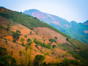
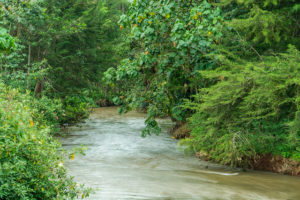
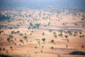
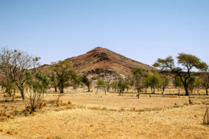
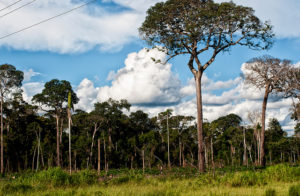
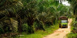
Borneo, a landmass shared by Indonesia, Malaysia and Brunei Darussalam, is home to some of the most diverse ecosystems on Earth. But forest fires and land conversion for logging, plantations and infrastructure development have reduced the island’s old-growth forest area by 30 percent since 1973.

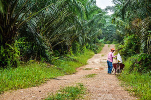
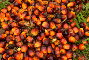
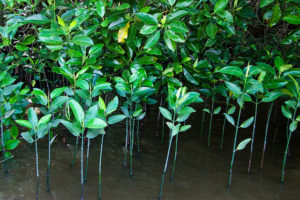
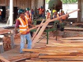
Expansion of plantations for palm oil and pulp and paper has been associated with significant forest loss in Borneo, especially in Indonesia and Malaysia as the world’s leading producers of palm oil.

The ongoing research is looking at how pledges to stop this trend are having an effect, both inside and outside of plantation concession areas.

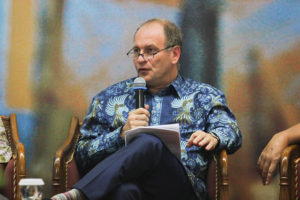
David Gaveau, co-creator of the newly updated Atlas of Deforestation and Industrial Plantations in Borneo, has been working on developing tools for buyers, traders, producers, governments and consumers to track industrial agriculture supply chains in Borneo, and monitor their impact on forests. He sat down with Forests News this week to discuss ongoing research, and what he and his partners have found so far.

What does it mean for a company to make a ‘No deforestation’ commitment?

When we talk about deforestation-free palm oil or paper, we are talking about products that have not been extracted from plantations established in place of forests. That is, where no forests have been cleared and converted to plantations. What this means in practice is that the products should come from plantations established on lands that have been cleared for other reasons, for example by wildfire, such as degraded shrublands.

A large number of palm oil and paper buyers and traders have already pledged to source only deforestation-free palm oil or paper, and in turn, the largest palm oil and pulp and paper producers have promised to stop clearing forests to expand plantations. Some made this pledge in 2013, with immediate effect. So in our research, we have sought to analyze whether those pledges, made with immediate effect, reduced overall rates of forest loss in Borneo.

Read more: New map helps track palm-oil supply chains in Borneo

Why are companies making ‘No deforestation’ commitments? Does it have any effect on profits?

Companies are making these commitments under pressure from consumer groups, environmental NGOs, and now even financial markets. For far too long, extractive industries made profit without respecting the environment. Times are changing.

An oil palm worker cleans up the trees before fruit collection. Photo by I. Cooke Vieira/CIFOR

How is a commitment monitored, and by whom?

Ideally, commitments should be monitored by tracking the palm oil back to the plantation where it was produced, and by verifying whether this plantation has been established at the expense of a forest, or whether it has replaced degraded, non-forested lands.

Have these pledges had an observable impact on deforestation rates in your research area in recent years?

Borneo is a major center for palm oil production. The area of industrial oil palm plantations in 2016 reached 8.3 million hectares — about half of the estimated global planted area of 18 million hectares. Old-growth forest area losses averaged 350,000 hectares annually from 2001 to 2016. By old-growth, we mean ancient forests that have never been impacted by humans, or forests impacted by timber extraction, but which have not been totally been cleared, and where the structure of a forest remains.

We showed in a paper published last year that the expansion of industrial oil palm plantations was responsible for 50 percent of all of Borneo’s old-growth forest area lost between 2005 to 2015. This number rises to 56 percent if we include pulpwood plantations. So, if producing companies stop clearing forests to expand plantations, deforestation should drop dramatically.

Our preliminary results from ongoing research suggest that recent corporate commitments to stop clearing forests in concessions of oil palm and pulpwood are associated with less conversion of forests to industrial plantations in Borneo, at least for oil palm and pulpwood.

We find that this company-driven deforestation peaked in concessions in 2009 and again in 2012, and has since been decreasing since 2012. In 2016, it had decelerated to 14-year low. This decreasing trend appears in Indonesian and Malaysian Borneo, and suggests that ‘No Deforestation’ commitments have slowed forest conversion within concessions in both countries. But that is not the whole story.

Despite this positive finding, the area of forest cleared since 2013 has in fact increased in Borneo. In Kalimantan — Indonesian Borneo — in particular, forests in 2016 were cleared at the fastest rate since 1997, with nearly 400,000 hectares lost that year. Much of this deforestation was caused by uncontrolled El Niño fires during late 2015, but appeared in 2016 satellite data because of cloud cover.

We find that much of this deforestation occurred outside concessions, and on peatlands, highlighting the urgent need to prevent peatland fires in the future, and to find solutions to deforestation outside concessions, where companies do not have jurisdiction. We also see a troubling trend in concessions where a lot of forest remains. In those forest-rich concessions, company-driven deforestation has not slowed, suggesting that ‘business as usual’ has continued in undeveloped concessions.

Read more: Financing farmers: Can funds for oil palm help save our forests?

How do you measure or observe the impact of commitments on forests?

We have mapped then analyzed the area of forest converted each year to industrial oil palm and pulpwood plantations from 2001 to 2016, looking mainly at land under company management – that is, concessions. We use LANDSAT satellite imagery to monitor the annual expansion of plantations.

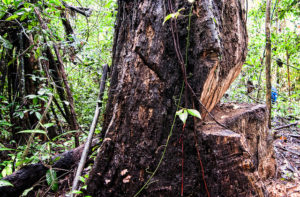
We combine this information with annual maps of forest loss also derived using LANDSAT satellites by Matthew Hansen’s research group at the University of Maryland. The Hansen dataset, as we call it, produces very accurate tree loss maps over the humid tropics, and combined with a good forest mask, reveals where old-growth forests have been cleared.  However, this dataset does not tell us why forest has been cleared, or who cleared it.

By combining our annual maps of plantations with this forest loss dataset, we can extract the area of forest converted each year to industrial plantations by producing companies. This is what we call company-driven deforestation.

What about the effect outside of concession areas, or in nearby forests?

Deforestation caused by fire is even more dramatic in Borneo outside concessions, where it recently jumped by 400 percent to a 16-year high in 2016.

What plans do you have for researching this further, and drawing recommendations for action?

We now aim to understand other drivers of deforestation in the Borneo landscape. For example, we are quantifying the impacts of forest fires, and smallholder and mining activity. We aim to equip governments, NGOS and companies with the capacity to see the full impact of the human enterprise on Borneo forests, and to act accordingly to bring the rate of forest loss down to zero.

By Catriona Croft-Cusworth, originally published at CIFOR’s Forests News

For more information on this topic, please contact David Gaveau at d.gaveau@cgiar.org.


This research forms part of the CGIAR Research Program on Forests, Trees and Agroforestry, which is supported by CGIAR Fund Donors.

This research was supported by UK aid from the UK government and the United States Agency for International Development (USAID).


Notice: Undefined index: id in /home/ft4user/foreststreesagroforestry.org/wp-content/themes/FTA/template-parts/content.php on line 3
  • Home
  • ‘Grain for green’: How China is swapping farmland for forest

‘Grain for green’: How China is swapping farmland for forest


Notice: Undefined variable: id_overview in /home/ft4user/foreststreesagroforestry.org/wp-content/themes/FTA/template-parts/content.php on line 64
A patchwork mountain landscape of agriculture, forestry and deforested terrain in Tianlin County, China. Photo by Nick Hogarth/CIFOR
Posted by

FTA COMMUNICATIONS TEAM

A legally protected ancient tree in Yunnan Province, China. The country’s successes in Forest Landscape Restoration are drawing attention globally. Photo by L. Putzel/CIFOR

Research draws lessons for global restoration goals.

Since 1999, China has restored forest landscapes across more than 28 million hectares of farmland and land classified as barren or degraded.

As global efforts turn to restoration as a way to mitigate climate change – led by the Bonn Challenge, with the goal of restoring 150 million hectares of deforested and degraded land by 2020, and 350 million hectares by 2030 – researchers are looking to China for lessons on how to achieve this.

A major driver of China’s success has been the ‘Conversion of Cropland to Forest Program’ (CCFP), also known as ‘Grain for Green’. The program pays farmers to plant trees on their land and provides degraded land to rural families to restore.

CCFP has so far cost more than $US40 billion, including direct payments to more than 32 million rural households. Overall, this massive program has affected the lives of 124 million people. The program is particularly important for China as 65 percent of the country’s total land area is mountainous and hilly, and a large proportion of China’s farmers live on sloping lands.

Some instructive findings have emerged from a four-year study by the Center for International Forestry Research (CIFOR) in partnership with scientists from China’s Forest Economics and Development Research Center (FEDRC). Under the research program known as SLANT – Sloping Lands in Transition – CIFOR became the first foreign organization to access data from China’s national restoration program.

“We wanted to get a better understanding of the socioeconomic and environmental benefits and impact of CCFP through its monitoring program. There is still a lot more to learn, especially about the effect of the program on a variety of ecosystem services,” says Yustina Artati, a CIFOR research officer.

Read more: China’s conversion of cropland to forest program: a systematic review of the environmental and socioeconomic effects

A patchwork mountain landscape of agriculture, forestry and deforested terrain in Tianlin County, China. Photo by Nick Hogarth/CIFOR

RESTORING CHINA’S FORESTS

Louis Putzel, a former CIFOR scientist who led the SLANT program, says China has suffered serious consequences from deforestation in the past, and has had to implement a huge range of strategies to get trees back into the landscape.

This has included taking the approach of FLR, Forest Landscape Restoration, which aims to improve ecological functions and human well-being.

“FLR as a field has a lot to learn from China,” says Putzel.

Research collaboration through SLANT has focused on rigorous data collection and analysis, as well as support for environmental assessments. This work is helping scientists identify any research gaps, learn what works and what needs improvement.

Putzel says the development community, as well as national governments implementing reforestation projects, need to know how the approach has worked in China.

Each year, the FEDRC researchers and data investigators visit farmers annually in 21 provinces to find out firsthand the successes and also the challenges these communities face. The results can eventually help communities make more informed decisions that affect their land and livelihoods.

“We have been working with our Chinese counterparts to ensure that the data collection is the best it can be. Surveys have been done of thousands of farm families and the results can help not only China, but the global community,” says CIFOR researcher Himlal Baral.

He adds that plans are being made for further research collaboration with several other Chinese research institutions, including work with Renmin University and Beijing Forestry University on the socioeconomic and biophysical aspects of forestry, landscape restoration and climate change.

Key findings from SLANT have been shared through workshops, presentations, and key events, and of course research papers – to date, more than 70 have been published.

SHARING THE KNOW-HOW

Ethiopia is just one example of how other countries can learn from China’s success. Scientists and government forestry officials from China and Ethiopia have been brought together under the SLANT program to share experiences and find solutions to problems that can have a negative impact on reforestation programs.

Last year, Chinese researchers were able to see for themselves the challenges Ethiopia faces during a field visit and provide some FLR solutions for Ethiopia to reach its goal of restoring 15 million hectares of degraded forests.

CIFOR researchers have been working with a number of China’s national agricultural and forestry research institutes for more than 15 years, and this partnership has resulted in a rich source of information and data that can be used to improve agricultural and forestry strategies as well as rural livelihoods.

“During our long-standing collaboration with China, we have benefited from the knowledge and conceptual inputs of our Chinese colleagues on forestry-related matters as they apply in China — from bamboo enterprise value chains, to the role of forestry Chinese enterprises abroad, to more recent forest restoration,” says Robert Nasi, CIFOR’s Director General.

Nasi says this collaboration has opened the door to invaluable knowledge and data on the Chinese land restoration programs, which are among the world’s largest.

“We would like to expand to new topics with additional resources focusing on forest product value chains and forest landscape restoration considering important cross-cutting issues like tenure and climate change,” he says.

Read more: CIFOR/ICRAF sloping lands in transition (SLANT) project

By Suzanna Dayne, originally published at CIFOR’s Forests News


For more information on this topic, please contact Himlal Baral at h.baral@cgiar.org or Yustina Artati at y.artati@cgiar.org.

This research forms part of the CGIAR Research Program on Forests, Trees and Agroforestry, which is supported by CGIAR Fund Donors.

This research was supported by UK aid from the UK government.


Notice: Undefined index: id in /home/ft4user/foreststreesagroforestry.org/wp-content/themes/FTA/template-parts/content.php on line 3
  • Home
  • New map helps track palm-oil supply chains in Borneo

New map helps track palm-oil supply chains in Borneo


Notice: Undefined variable: id_overview in /home/ft4user/foreststreesagroforestry.org/wp-content/themes/FTA/template-parts/content.php on line 64
A woman begin to harvest oil palm fruit in Kalimantan. Photo by I. Cooke Vieira/CIFOR
Posted by

FTA COMMUNICATIONS TEAM

A woman begin to harvest oil palm fruit in Kalimantan. Photo by I. Cooke Vieira/CIFOR

The updated Borneo Atlas offers new data to measure the impact of mills and plantations on forests.

In 2013, a number of major palm-oil buyers, traders and producers promised to stop clearing natural forests. The global multi-billion-dollar business of palm oil is among the world’s most controversial agro-industries. It has been implicated in numerous cases where species- and carbon-rich forests have been cleared, yet it also contributes to the elimination of poverty in producer countries.

Indonesia and Malaysia are the world’s top two producers of palm oil. Their area of industrial plantations more than quadrupled in extent from 1990 to 2015. Over the same period, regional rates of forest loss rose to among the world’s highest. Forest clearance is driven by a number of factors — establishing plantations is one factor. The development of mills and associated infrastructure to extract and transport palm oil also impacts forests.

The latest version of the Atlas of Deforestation and Industrial Plantations in Borneo, or what we call the Borneo Atlas, part of the work of the CGIAR Research Program on Forests, Trees and Agroforestry (FTA) launched this week allows users to verify the location and ownership of 467 palm-oil mills in Borneo, the island shared by Indonesia, Malaysia and Brunei Darussalam. It includes a new tool called Analyze Land Use near Mills to provide verified information on the location of palm-oil mills, and the deforested area within a 10-kilometer radius, as detected annually by satellites.

The new tool can be used together with an earlier tool called Analyze Land Use in Concessions, to track the footprint of palm-oil growers on forests. It links the company-driven forest loss (i.e. the forest area converted each year to industrial plantations) detected annually using satellites with publicly available concession maps. Combined, these two tools are useful for the increasing number of palm-oil buyers, traders and government officials who have begun tracing supply chains to mills and plantations. Buyers are currently focusing their attention on traceability to mills, because the location of a mill is a good indicator of the approximate location of its supplier.

Understanding where mills and plantations are is also useful to better understand the overall impact of industrial palm-oil developments on tropical rainforests.

Try it: Atlas of Deforestation and Industrial Plantations in Borneo

ADDED FEATURES

Via the interactive map, users can zoom in on a 10-kilometer radius of each mill — the distance fresh palm fruit can travel without spoiling. The actual distance that fruit has travelled to reach the mill in fact vary depending on commercial agreements, road networks and terrain, and does not fall into a perfect disc around the mill.

However, this simplified added feature does offer a more complete view of the impacts of industry on forests. Users can rank concessions and mills by recent clearing, and access statistics on forest health and land use. They can visualize poorest and best performing mills and concessions by company, soil type (peat and non-peat), by remaining forest area, and by type of certification.

The idea is to offer the opportunity to investigate to what extent plantation companies have cleared forests in Borneo, and to what extent they have avoided forest loss by planting on non-forested lands. Understanding where companies practice sustainable planting is key to engaging and promoting positive actions by companies.

We developed this dataset by reviewing online documentation on company dashboards, NGO websites, certification agencies (RSPO and ISPO), mapping websites and social media. The source documents for these data are linked in the results of each search so they can be consulted by users. A link to the mills’ location on high-resolution imagery from Google Maps and ArcGIS World Imagery is also provided for each search, to prove that the mill exists.

Future developments will include linking mills to supplier plantations, to ports and refineries, and incorporating time-lapses to reveal how industrial oil palm has expanded.

Read more: What a difference 4 decades make: Deforestation in Borneo since 1973

Individual oil palm fruits are seen in Kalimantan. Photo by I. Cooke Vieira/CIFOR

AN INDUSTRIAL-SCALE ISSUE

Palm oil is produced by industrial means. It is in everything from cosmetics to processed food, and biofuels to drive cars. It requires extensive infrastructure, including processing mills and refineries. Ultimately, huge tankers ship the oil to every corner of the globe.

Oil palm isn’t the only industrial crop. Today, most of the world’s food production and supply is done by industrial means. Industrial agriculture is a system of chemically intensive food production, featuring gigantic single-crop farms and production facilities, controlled by large conglomerates.

Intensive monoculture depletes soil and leaves it vulnerable to erosion. Herbicides and insecticides harm wildlife and people. Biodiversity in and near monoculture fields takes a hit, as populations of birds and beneficial insects decline. In fact, the abundance of flying insects has plunged by three-quarters over the past 25 years in the European countryside because of industrial agriculture, according to a new study.

In the humid tropics, industrial production of palm oil, soy, pulpwood and beef depletes biodiversity by being responsible for between 35% and 68% of all tropical forest loss.

Rates of forest loss and oil-palm developments are particularly marked on Borneo. Forest losses averaged 350,000 hectares annually from 2001 to 2016, while by 2016 the area of industrial oil palm plantations reached 8.3 million hectares (Mha) — about half of the estimated global planted area of 18 Mha. From 2005 to 2015, the expansion of industrial oil palm plantations was responsible for 50 percent (2.1 Mha) of all of Borneo’s old-growth forest area loss (4.2 Mha).

Tools like the Borneo Atlas, and its new feature to assess the impact of mills, aim to equip governments, NGOS and companies with the capacity to see the full impact of industrial agriculture on forests, and to act accordingly to bring the rate of forest loss in their supply chains down to zero.

Read more: For a better Borneo, new map reveals how much terrain has changed

By David Gaveau and Mohammad Agus Salim, originally published at CIFOR’s Forests News


For more information on this topic, please contact David Gaveau at d.gaveau@cgiar.org or Mohammad A. Salim at m.salim@cgiar.org.

This research forms part of the CGIAR Research Program on Forests, Trees and Agroforestry, which is supported by CGIAR Fund Donors

This research was supported by UK aid from the UK government and the United States Agency for International Development (USAID).


Notice: Undefined index: id in /home/ft4user/foreststreesagroforestry.org/wp-content/themes/FTA/template-parts/content.php on line 3
  • Home
  • Ebola outbreaks linked to forest loss, new study finds

Ebola outbreaks linked to forest loss, new study finds


Notice: Undefined variable: id_overview in /home/ft4user/foreststreesagroforestry.org/wp-content/themes/FTA/template-parts/content.php on line 64
A river rund through Mau Forest in Kenya. Photo by P. Shepherd/CIFOR
Posted by

FTA COMMUNICATIONS TEAM

Wildmeat is sold at Bartica market in Guyana. Photo by M. Lopez/CIFOR

Scientists track the disease to the edge of newly cleared forests.

News of an Ebola Viral Disease (EVD) outbreak strikes fear not only in Africa where it originates, but around the world. In humans, the virus produces severe symptoms such as bleeding from the eyes, nose and mouth, loss of consciousness, seizures and eventual death.

First discovered in 1976 in Central Africa, the worst outbreak happened between 2014-2016 when the virus rapidly spread through Liberia, Sierra Leone and Guinea, killing more than 11,000 men, women and children. Cases were also reported in Mali, Nigeria, Senegal, Spain, Italy, the United Kingdom and the United States. With no known cure, governments must rely on prevention and control strategies to contain new outbreaks.

But in a new study, scientists from the Center for International Forestry Research (CIFOR), Spain’s Universidad de Malaga and other partner institutions have uncovered a vital piece of the Ebola puzzle — when and where outbreaks can occur.

Watch: Let’s talk about bushmeat

TIMING IS EVERYTHING

“Since Ebola is transmitted to humans from wild animals we were initially very interested in the link between the virus and bushmeat practices,” says Professor John E. Fa, a Senior Associate at CIFOR and a Professor at the UK’s Manchester Metropolitan University.

“This led us to the next question: we knew there was no evidence that Ebola happens in cycles, so we asked, ‘What other conditions on the ground are there to encourage this virus to flourish and infect people?’” says Fa.

A river runs through Mau Forest in Kenya. Photo by P. Shepherd/CIFOR

The team — made up of practitioners, landscape ecologists and modellers, the latter led by Dr. Jesus Olivero of the Faculty of Sciences in Malaga — joined forces to investigate patterns of forest loss in areas where Ebola disease outbreaks had been recorded, and other sites where no outbreaks had occurred. The question to be answered was whether there were substantial differences in the rates and extent of deforestation in these two distinct types of sites.

“The comparison is remarkable. In the outbreak areas, it’s not just more deforestation, but there is also greater forest fragmentation,” says Olivero.

The scientists point out that as large forest blocks are broken up into smaller fragments, this may become an open invitation for new instances of contact to take place between humans and potential natural carriers, thereby increasing the risk of an outbreak.

Although the possible link between forest loss and zoonotic disease has been suggested before, the findings of the present work provide strong evidence of an association between Ebola outbreak locations and deforestation. The breakthrough in the new study occurred when the team noted a pattern in the timing of deforestation prior to the outbreaks.

“For the first time, we saw a direct correlation between forest fragmentation and when EVD outbreaks happen,” says Olivero.

“We found that EVD outbreaks tended to occur in areas that experienced forest loss up to two years prior.”

Read more: Eating and conserving bushmeat in Africa

GETTING A HEADS UP

The research team says the data could lead to the development of an early warning system, which means governments in Ebola risk regions can get a head start on implementing interventions. This is key, because most EVD outbreaks happen in remote, rural communities where there are few resources.

“Once we know where these potential hotspots are, we can create a map showing where an outbreak is likely to occur and mobilize people and resources to monitor local communities,” says Fa.

This means that surveillance and medical teams, as well as community awareness activities, could make preparations in identified high-risk areas before the virus strikes and, in doing so, save lives.

AN OUNCE OF PREVENTION 

A sign advertises wild meat in Guyana. Photo by M. Lopez/CIFOR

The new study clearly suggests that preserving forested areas must be a high priority for nations throughout the world.

“Tropical rainforests are chock-a-block with species of all kinds, including pathogens, which means that for such a high diversity of animal hosts there are corresponding parasites, viruses, and so on,” notes Fa.

“Our feeling is that once you start playing around with an ecosystem, you might have a flurry of activity of viruses that may even start looking for new hosts,” he adds.

Fa says much more needs to be done to fully understand how EVD outbreaks occur, and how the virus is transmitted. The team is currently looking at how outbreaks may be influenced by climate, and how potential Ebola host animals, such as bats, may be linked to deforestation.

“It is now fundamental to go to the field to find out what creates disease flurries, and also to do more research into different types of forests with different levels of deforestation. We need to know what happens to the species, what happens to the virus, in these areas,” he says.

Fa adds that it’s crucial to look at the big picture, at how emerging infectious diseases like Ebola are moving out of remote areas and infecting the general public, and the role that nature plays.

“We see the importance of keeping biodiversity intact,” he concludes.

Watch: Future solutions for bushmeat in Colombia

By Suzanna Dayne, originally published at CIFOR’s Forests News

This research is part of CIFOR’s Bushmeat Research Initiative. For more information on this topic, please contact John E. Fa at jfa949@gmail.com or Jesus Olivero at jesusolivero@uma.es.


This research forms part of the CGIAR Research Program on Forests, Trees and Agroforestry, which is supported by CGIAR Fund Donors. It is also supported by UK aid from the UK Government and USAID. 


Notice: Undefined index: id in /home/ft4user/foreststreesagroforestry.org/wp-content/themes/FTA/template-parts/content.php on line 3
  • Home
  • From Balikpapan to global climate action

From Balikpapan to global climate action


Notice: Undefined variable: id_overview in /home/ft4user/foreststreesagroforestry.org/wp-content/themes/FTA/template-parts/content.php on line 64
Mangrove seedlings grow in Tanjung Puting National Park, West Kalimantan. Photo by D. Murdiyarso/CIFOR
Posted by

FTA COMMUNICATIONS TEAM

People attend the Governors’ Climate and Forests Task Force meeting in Balikpapan, Indonesia, in September 2017. Photo by A. Sanjaya/CIFOR

COP23 special: A diverse group moves from local to global in the fight against deforestation and climate change.

Promising to stop cutting down forests is one thing. Actually doing it is another.

At the recent Governors’ Climate and Forests (GCF) Task Force Annual Meeting in Balikpapan, Indonesia, representatives hailing from disparate parts of the world – and mostly tropical states – met to discuss just how to do that. There they launched the Balikpapan Statement, which focuses on sustainable supply chains, the rights and livelihoods of indigenous communities and long-term financing.

At the COP23 in Bonn, Earth Innovation Institute (EII), the GCF Task Force and partners will hold a series of events to further the commitments made in Balikpapan.

“The GCF Task Force is an innovative global partnership of states and provinces that’s been working for nearly nine years. It’s now up to 38 members and growing. Its purpose is pretty simple and big: helping subnational governments in the tropics shift to forest-maintaining, sustainable development,” said EII Executive Director Daniel Nepstad.

Read more: FTA at COP23

With one focus on implementing the Reducing Emissions from Deforestation and Forest Degradation (REDD+) international framework at the subnational level, the discussions are integral pieces in the puzzle of global climate action exemplified by COP23.

Center for International Forestry Research (CIFOR) scientist Stibniati Atmadja, whose work focuses on provincial-level REDD+, said at the GCF Annual Meeting, “These kinds of fora are important to get the message across about what states are doing to contribute to climate change mitigation, especially that states are committing to these activities based on forestry and that they have important lessons that others can learn.”

“At the international level in negotiating at the UNFCCC, these messages are very important,” she added.

With COP23 in Bonn from 6-17 November including a swath of climate discussions from the local and provincial to national, regional and global levels, it is essential that people understand what is happening on the ground in diverse states, in tropical forests, in muddy peat and in tangled mangroves.

WET AND WILD

Mangrove seedlings grow in Tanjung Puting National Park, West Kalimantan. Photo by D. Murdiyarso/CIFOR

“I work in a number of provinces like West Papua, East Kalimantan and West Kalimantan that have a lot of potential to be part of climate solutions as far as wetlands are concerned. But wetlands and their role in climate mitigation is not on the radar of many governments, nor are the benefits to keeping them intact and protecting them,” CIFOR scientist Daniel Murdiyarso said at the Balikpapan meeting.

At the Indonesia Pavilion at COP23, CIFOR and Indonesia’s Peatland Restoration Agency (BRG) will host a discussion on the collective action required to restore these spaces, which have an integral role to play as carbon sinks and as part of the country’s commitment to reducing emissions.

“The Mahakam Delta wetlands in East Kalimantan are one area with carbon-rich mangroves, but they are facing tremendous pressure from the expansion of shrimp ponds,” Murdiyarso said.

He added, “How the region will manage and govern such assets is key. The actions to be taken by the Forest Management Unit is worth the attention to take a closer look.”

Read more: An explanation of Green Climate Fund payments

TRANSFORMATIONAL

Governance and solving the climate issue go hand-in-hand, and one-third of the world’s tropical forests are in GCF Task Force states and provinces, including more than three-fourths of Brazil’s and Peru’s and more than half of Indonesia’s.

As CIFOR scientist Amy Duchelle said on the sidelines of the GCF Task Force meeting about one of the member states where she has conducted research for many years, “If we think about transformational change, the case of Acre in Brazil with its State System of Incentives for Environmental Services is an interesting example. It entailed a governance structure change that brought together many different kinds of policies under one umbrella towards forest-based development.”

At COP23, CIFOR’s side event will look at just such examples of change and what gaps remain in the battles to reduce emissions and halt deforestation, including reflections from a subnational government representative.

Duchelle said, “We are starting a new collaboration with the GCF Task Force, EII and the Climate, Community and Biodiversity Alliance to assess the progress of jurisdictions towards low emissions rural development. One big research question now is ‘What are the enabling conditions, and key policies and interventions, that can lead to positive environmental and socioeconomic outcomes on the ground?’”

People sit in front of a village house in Kalimantan. Photo by I. Cooke Vieira/CIFOR

BOTTOMS UP

In opening remarks at the GCF Task Force meeting, Governor Awang Faroek of East Kalimantan said, “Through these discussions, we hope to come to a consensus in how to best establish realistic strategies in order to realize development that is not only environmentally sustainable, but also socially inclusive.”

This realism stems from seeing things clearly on the ground. At the meeting in Balikpapan, emphasis was placed on the need for successful local processes, with GCF Task Force chair William Boyd saying, “This is what bottom-up climate governance looks like,” as he scanned a room of representatives from across the world that included indigenous leaders, governors and civil society heads.

Read more: Sharing better, for better research

On such governance, Mudiyarso said, “Bottom-up processes are very important because the agenda is clear, but we also need to understand the top-down process and find a meeting point. Local governments need to be informed about what’s going on at the national level, and the national-level government also has to be very accommodating with the specifity at the provinces.”

He suggested one necessary meeting space between such processes could be financing, with Atmadja in agreement.

“REDD+ is seen as a way to fund what provinces want to do. For example, from my interviews in Aceh, in general they’re saying REDD+ is a great opportunity to fund our green vision,” she said.

She added, “I think this kind of viewpoint is very sustainable because REDD+ is here now and ten years from now it may evolve into something else. But if it supports objectives that come from within, then it’s even more sustainable.”

At COP23 in Bonn, such intersecting, transnational discussions continue, all with aim of change both big and small.

By Deanna Ramsay, originally published at CIFOR’s Forests News


This research forms part of the CGIAR Research Program on Forests, Trees and Agroforestry, which is supported by CGIAR Fund Donors.

This research was supported by UK aid from the UK government.


Notice: Undefined index: id in /home/ft4user/foreststreesagroforestry.org/wp-content/themes/FTA/template-parts/content.php on line 3
  • Home
  • Community concessions bring newfound hope for forest conservation and socioeconomic development

Community concessions bring newfound hope for forest conservation and socioeconomic development


Notice: Undefined variable: id_overview in /home/ft4user/foreststreesagroforestry.org/wp-content/themes/FTA/template-parts/content.php on line 64
Men in a community forest enterprise in Petén, Guatemala, involved in milling precious woods. Photo by D.Stoian/Bioversity International
Posted by

FTA COMMUNICATIONS TEAM

Men in a community forest enterprise in Petén, Guatemala, involved in milling precious woods. Photo by D. Stoian/Bioversity International

Recent findings evidenced that when forests are in the hands of local communities, governance, conservation and livelihoods improve.

Reform advocates claim that local communities are better stewards of forests than the state, particularly in settings where understaffing and other limitations do not allow government agencies to live up to their mandate.

There is increasing evidence that the devolution of rights to forest communities leads to a decrease in deforestation rates, better protection of biodiversity, and significant livelihood benefits of community members, especially if linked to the development of community forest enterprises.

Bioversity International and partners are contributing to this evidence base through large-scale socioeconomic surveys in the Petén region of Guatemala where 25-year forest concessions have been granted to the communities in the late 1990s.

CGIAR Research Program on Forests, Trees and Agroforestry (FTA) scientist Dietmar Stoian of Bioversity International, who has led this research since 2014 says: “For the first time there is a complete socioeconomic data set across the nine active concessions, which show that, if carefully managed, the community concessions allow local people to move out of poverty while conserving the forest and its inherent biodiversity.”

“While we observe significant variation across and within the concessions, community stewardship of the forest resources has proven to be a viable model for forest conservation and livelihoods development,” he adds.

Members of a community forest enterprise grade leaves of the Chamaedorea palm for export. Photo by D. Stoian/Bioversity International

As the community concessions need to undergo renewal over the next few years, Bioversity International, Center for International Forestry Research (CIFOR) and the Asociación de Comunidades Forestales de Petén (ACOFOP) — the umbrella organization of forest communities in the Petén — organized a workshop in September.

Over 40 researchers, practitioners, and policy makers, attended the workshop to take stock of existing evidence of the concessions’ environmental and socioeconomic performance and to discuss options going forward.

CIFOR scientist Steven Lawry explained in an interview with Forests News that the approach has produced positive results: “Deforestation rates within the concessions are markedly lower than in surrounding areas. Employment has increased, and community members receive dividends from timber sales.”

What is more, the resident forest communities are now able to make an income also from regulated hunting, collecting non-timber forest products, farming, and working off-farm. The diversification of their income sources contributes to their improved livelihoods by providing greater stability and food security.

“The community forest concession model has informed other ongoing processes for rights devolution in forest regions,” said Iliana Monterroso, co-organizer of the workshop on behalf of CIFOR. In fact, Indonesia, China and Colombia are looking at how the forest concession model might benefit their countries.

Originally published on the website of Bioversity International.


This research has been supported by the Austrian Development Agency (ADA) with funding by the Austrian Development Cooperation (ADC). It is part of the CGIAR Research Programs on Policies, Institutions and Markets (PIM) and Forests, Trees and Agroforestry (FTA) and is supported by CGIAR Fund Donors. We thank ADA and ADC for their funding and all donors who support PIM and FTA through their contributions to the CGIAR Fund.


Notice: Undefined index: id in /home/ft4user/foreststreesagroforestry.org/wp-content/themes/FTA/template-parts/content.php on line 3
  • Home
  • Finding a way in for better landscape governance

Finding a way in for better landscape governance


Notice: Undefined variable: id_overview in /home/ft4user/foreststreesagroforestry.org/wp-content/themes/FTA/template-parts/content.php on line 64
A water porter makes his way to a gold panning area in Sindri village, Burkina Faso. Photo by O. Girard/CIFOR
Posted by

FTA COMMUNICATIONS TEAM

A dry landscape is seen in Burkina Faso. Photo by D. Tiveau/CIFOR

Study in Ghana and Burkina Faso finds an entry point for landscape approaches in natural resource management schemes.

Landscape approaches provide a framework to find solutions to social, environmental and economic challenges in Africa. In the past, sectoral approaches were often used to manage land, but more and more experts agree that integrated approaches are needed to ensure that landscapes are managed sustainably.

With this kind of approach, a landscape would be managed in such a way that it provides environmental services for more than one group or sector. For example, a single landscape could be managed in an integrated way to become a source of water for local communities and agriculture, provide trees for timber, support local biodiversity and give shade for cocoa farming. In this way, integrated landscape approaches can also contribute to solving global environmental challenges such as biodiversity loss, food insecurity and climate change.

Read also: Stepping up to the challenge to end poverty and hunger without trashing the planet

Scientists from the University of Amsterdam (UvA) and Center for International Forestry Research (CIFOR) explored three established natural resource management schemes in the West African nations of Burkina Faso and Ghana to see if they could identify locally embedded entry points for implementing integrated landscape approaches.

“All three have interacting land uses, whether through agroforestry systems common throughout Burkina Faso, or a mosaic of wildlife reserves, food production and timber tree planting in Ghana,” said researcher Mirjam Ros-Tonen from the University of Amsterdam.

“But they all face deforestation, biodiversity loss, climate change and persistent poverty,” added Samson Foli, also from UvA.

A water porter makes his way to a gold panning area in Sindri village, Burkina Faso. Photo by O. Girard/CIFOR

THREE SCHEMES, THREE RESULTS

All three schemes target landscape degradation and involve local communities. The Chantier d’Aménagement Forestier (CAF) scheme encompasses forest management sites across Burkina Faso.

In Ghana, the Modified Taungya System (MTS) aims to restore degraded forest reserves while allowing farmers to interplant food crops, and the Community Resource Management Areas (CREMAs) target wildlife conservation and livelihood diversification at the fringes of protected areas and wildlife reserves, through participatory natural resource management.

The team scored each scheme on five design principles for integrated landscape approaches derived from a previous study. These include extent of integration, adaptive management and continual learning, polycentric governance, multi-stakeholder involvement and capacity-building. The degree of alignment with these principles help identify the strengths and weaknesses of the schemes as entry points for landscape approaches.

“We found challenges in all areas to varying degrees. For example, we found that farmers in Ghana’s MTS had a share in the timber revenues but little say in the design, implementation and running of the MTS,” says Ros-Tonen.

“Secondly, farmers are unable to produce food on MTS lands after about three years when food crops do no longer survive under the shade of the canopy.”

Read also: Forests as food: New report highlights important relationship between forest landscapes and healthy diets

The study shows that a lack of long-term funding and economic incentives threaten the program, while top-down governance arrangements stifle a genuine move toward more collaborative decision-making, power-sharing and institutional diversity.

In Burkina Faso, it was a similar story.

Trees dot the scenery in the Kongoussi area, Burkina Faso. Photo by O. Girard/CIFOR

“In Burkina, the CAF scheme called for co-ops to be involved in decision-making, but a lot of the time local people don’t have the resources to go or prepare for the meetings, so they don’t attend,” Foli says.

ONE SCHEME RISES TO THE TOP

Although these two schemes could succeed if improvements are made, Ghana’s CREMA approach showed more potential.

“The CREMA does a better job at various levels by allowing people to be directly involved in conservation and natural resource use because they have total autonomy,” Foli says.

“They have the liberty to do establish ecotourism initiatives, or game sanctuaries, or other income-generating and local capacity-building projects. Because they are empowered, they have a progressive trajectory, and with government assistance, they receive periodic training from the Forestry Commission or NGOs,” he adds.

The study shows that the CREMA is the only scheme that explicitly deals with trade-offs between conservation and development aims. The CREMA was also found to take a more flexible approach compared to the other two schemes that have a more rigid decision-making structure.

The researchers found that government forestry and land-use planning institutions conduct conservation programs with little consideration for existing norms used by local people in conserving natural resources. Only the CREMA initiative takes local knowledge and practices for the conservation and sustainable use explicitly into account.

“But the CREMA isn’t perfect. We found that all three schemes needed to have a monitoring and evaluation component. This is especially needed here, as all three have been established as a response to failure of past conservation strategies. So we need to know if they are fulfilling their set goals or not,” Foli says.

MORE WORK AHEAD

The study also points to the need for continual learning and a management structure that can adapt to change. The researchers concluded that the CREMA can be improved by building platforms for the exchange and co-creation of knowledge and experimental learning at all levels. In other words, working toward a holistic landscape approach guided by an advanced set of the principles.

“We are also seeing more and more stakeholders becoming involved — NGOs, government, researchers, communities — and that’s a good thing. But for any scheme to be successful, the community and local groups need a bigger voice,” Foli says.

The researchers stress that a realistic perspective is needed to ensure integrated landscape approaches succeed, and that means being flexible in translating the guiding principles based on local context and conservation objectives.

By Suzanna Dayne, originally published at CIFOR’s Forests News


This research forms part of the CGIAR Research Program on Forests, Trees and Agroforestry, which is supported by CGIAR Fund Donors.

This research was supported by the Conservation and Sustainable use of Tropical Forest Biodiversity program financed by the United States Agency for International Development (USAID) and WOTRO Science for Global Development/Food and Business Applied Research Fund through the TREEFARMS project.


Notice: Undefined index: id in /home/ft4user/foreststreesagroforestry.org/wp-content/themes/FTA/template-parts/content.php on line 3
  • Home
  • Moving past tree planting, expanding our definition of forests and restoration

Moving past tree planting, expanding our definition of forests and restoration


Notice: Undefined variable: id_overview in /home/ft4user/foreststreesagroforestry.org/wp-content/themes/FTA/template-parts/content.php on line 64
Peruvian law prohibits the logging of Brazil nut trees — but the forest around them has been cleared, affecting the amount of nuts they produce. Photo by M. Simola/CIFOR
Posted by

FTA COMMUNICATIONS TEAM

Peruvian law prohibits the logging of Brazil nut trees — but the forest around them has been cleared, affecting the amount of nuts they produce. Photo by M. Simola/CIFOR

Secondary forests are often neglected and overregulated in forest management. Recognizing and governing those spaces is essential for proper landscape restoration.

What is a forest? And how do you restore one?

These seemingly simple questions were interrogated — with a focus on solutions — during a panel discussion at the 2017 Association for Tropical Biology and Conservation Meeting (ATBC), which recently concluded in Merida, Mexico.

A group of experts on Latin American forests examined both the conservation and restoration of secondary forests from a variety of angles, including the ecological, political and social dimensions of such spaces.

Beginning with the premise that “secondary forest regrowth following agricultural land use represents a major component of human modified landscapes across the tropics”, the panel emphasized the essential role of secondary forests for humans living in proximity, as well as for restoration initiatives and international goals, such as the United Nations Aichi Biodiversity Targets.

REORIENTING

“Natural regeneration in secondary forests has been overlooked, and can be a restoration tool for large-scale initiatives,” said panelist and Center for International Forestry Research (CIFOR) Principal Scientist Manuel Guariguata, whose work forms part of the CGIAR Research Program on Forests, Trees and Agroforestry (FTA).

The 12 July 2017 discussion titled “The role of tropical secondary forests in conservation and restoration” was a welcome exploration of these neglected landscapes, formerly native forest cleared for agriculture, ranching or other purposes and later deserted.

Research carried out across the tropics over the last few decades unanimously agrees that these lands, which then start to host trees and shrubs and slowly attract birds and other wildlife on their path to maturity, are valuable in countering primary forest loss and as providers of ecosystem services. With proper management, they provide both timber and non-timber products to people nearby – thereby proffering both social and ecological rewards.

Read the paper: Natural regeneration as a tool for large-scale forest restoration in the tropics: prospects and challenges

Freshly harvested Brazil nuts await processing in Peru. Photo by M. Simola/CIFOR

In a presentation titled “Key governance issues and the fate of secondary forests as a tool for large-scale forest restoration”, Guariguata said, “the permanence of secondary forests in tropical landscapes largely depends on good governance, particularly through continued dialogue between government agencies, particularly environment and agriculture ministries.”

Improved governance for improved forests “would include the recognition that secondary forests are part of highly dynamic land-use systems that can and do change and unlikely to be managed either by a single government sector or scientific discipline,” he added.

IN STEERAGE

This complexity is evident in the myriad of ways secondary forests are engaged with and understood.

Guariguata urged for a multifaceted, interdisciplinary approach to improve restoration processes beyond tree planting to incorporate secondary forests.

“Often, because of definitional, technocratic issues, foresters may not see a secondary forest as such because they are looking at specific criteria, even though there may be plenty of trees in secondary forests. Agronomists are trained to look at soil and vegetation and also may not see a forest. But forest smallholders do both — and we shouldn’t overlook that,” Guariguata said in a later interview.

“Education and training at the university level also needs to enhance interdisciplinarity,” he added.

Secondary forests can naturally regenerate, and with this in mind, there is an argument for letting nature take its course, so to speak. Guariguata said, “There’s a lot of inherent resilience in secondary forests and we can harness that.”

“There is a tradeoff, as some of these forests have a central human component and require more effort, others don’t need interventions, but they need governing. The process needs steering.”

Evidence of selective logging, which has coexisted with Brazil nut production for a long time but is becoming more intense, is seen in Peru. Photo by M. Simola/CIFOR

STEPPING STONES

Offering examples that demonstrate the differing approaches to secondary forests and the issues involved, from Peru to Indonesia and Ethiopia to Mexico, Guariguata zeroed in on Mexico’s success with steering.

“Mexico is redrafting its Forest Code with a reassessment of their definition of secondary forest. Until 2014, the code restricted traditional harvesting of timber and non-timber forest products due to definitional issues of what is and is not a secondary forest. The revision will allow forest users to harvest products from young secondary forests without a permit,” Guariguata said.

Such progress is in part a result of CIFOR’s recent synthesis on governance of forest restoration.

Read more: Success from the ground up: Participatory monitoring and forest restoration

At the opening of the panel discussion at ATBC, the moderator asked the audience: “Should secondary forest fragments be protected as conservation areas in regions with low forest cover and little primary forest remaining?”

The consensus was “yes,” and as the panel continued to discuss regenerating forests and their role in large-scale restoration initiatives and countries’ increasingly ambitious commitments to reforest degraded lands, the need for protection and proper management of such places became clearer and clearer.

These muddled yet vital spaces have a major role to play in forest landscape restoration, which, ultimately, means helping to mitigate the effects of climate change the world over.

By Deanna Ramsay, originally published at CIFOR’s Forests News

For more information on this topic, please contact Manuel Guariguata at m.guariguata@cgiar.org.


This research forms part of the CGIAR Research Program on Forests, Trees and Agroforestry. We would like to thank all donors who supported this work through their contributions to the CGIAR Fund


Notice: Undefined index: id in /home/ft4user/foreststreesagroforestry.org/wp-content/themes/FTA/template-parts/content.php on line 3
  • Home
  • What a difference 4 decades make: Deforestation in Borneo since 1973

What a difference 4 decades make: Deforestation in Borneo since 1973


Notice: Undefined variable: id_overview in /home/ft4user/foreststreesagroforestry.org/wp-content/themes/FTA/template-parts/content.php on line 64
Posted by

FTA COMMUNICATIONS TEAM

In 1973, 55.8 million hectares (76%), of Borneo was old-growth rainforest. About 19.5 million ha of old-growth forest area was destroyed between 1973 and 2016 by fire and agricultural expansion. By 2016, 50% of the island remained forested.


Notice: Undefined index: id in /home/ft4user/foreststreesagroforestry.org/wp-content/themes/FTA/template-parts/content.php on line 3
  • Home
  • New kid on the block in Indonesia’s timber export industry

New kid on the block in Indonesia’s timber export industry


Notice: Undefined variable: id_overview in /home/ft4user/foreststreesagroforestry.org/wp-content/themes/FTA/template-parts/content.php on line 64
Women assemble a sofa in Jepara, Central Java, Indonesia. Photo by M. Usman/CIFOR
Posted by

FTA COMMUNICATIONS TEAM

Women assemble a sofa in Jepara, Central Java, Indonesia. Photo by M. Usman/CIFOR

Forest Law Enforcement, Governance and Trade (FLEGT) licensing is like an anak sholeh — a good and pious child — according to several speakers at a recent national policy dialogue held in Jakarta, Indonesia.

From forests to workshops, marketplaces and homes, Indonesia’s timber products form a long and complex supply chain, which FLEGT is helping to regulate and strengthen.

The country’s timber exports are valued at US$11 billion annually. Thanks to its timber legality verification system known as SVLK and the subsequent issuance of FLEGT, with which businesses can export timber and wood products to the European Union with greater ease, the government expects furniture exports to increase significantly.

Indonesia is the only country in the world to have implemented the licensing so far, giving its furniture a competitive advantage in an increasingly discerning market as consumers pay more attention to the issues of a green environment, illegal logging, deforestation and sustainable production.

Watch: Policy dialogue: CIFOR cohosts FLEGT talks in Jakarta

Speakers pose with tokens of appreciation made from SVLK-certified wood following one of the sessions at the National Policy Dialogue in Jakarta. Photo by M. Edliadi/CIFOR

However, issues remain in the widespread implementation of FLEGT in Indonesia, especially among small and medium enterprises (SMEs).

The recent policy dialogue, cohosted by the Center for International Forestry Research (CIFOR) and supported by the CGIAR Research Program on Forests, Trees and Agroforestry (FTA) on July 13, tackled the topic of FLEGT licensing and supporting SMEs to access global markets.

The dialogue brought together scientists, government representatives, local furniture producers and community leaders to discuss challenges for SMEs to meet FLEGT requirements; a strategy to maximize the impacts of the license on SMEs; and the role of province and district governments to ensure the legality of SME production.

Read more: Indonesia’s timber going green – and global

Ida Bagus Putera Parthama, Director General of Sustainable Forest Management at Indonesia’s Forestry and Environment Ministry, said the initiative stemmed from an effort to eliminate illegal logging, and a desire to “stop the stigma attached to Indonesia about illegal wood.”

He described the license as “a good boy that the whole country has been waiting for” and said “everyone should support it.”

“The final outcome we expect from the system is to increase our market share, competitiveness of products, revenue for communities and in the end improve the livelihoods of those involved,” Parthama explained.

Charles-Michel Geurts, deputy head of the EU Delegation to Indonesia and Brunei, speaks at the National Policy Dialogue in Jakarta. Photo by M. Edliadi/CIFOR

Charles-Michel Geurts, deputy head of the EU Delegation to Indonesia and Brunei, concurred. “The world is looking to Indonesia,” he said. “Anak sholeh is a role model; everybody likes him [and] wants to adopt him.”

However, some business people voiced concerns. Jepara Small-Scale Furniture Producers Association (APKJ) representative Sulthon Muhamad Amin said that while medium and large companies may not be lumbered with the requirements, the costs associated with the licensing were too onerous for small-scale workshops. Thus, some still preferred to partner with exporters in the local market rather than become exporters themselves.

Sulthon later said small businesses must change this mindset. However, he questioned how this could happen, stating that many small-scale businesses had never heard of FLEGT.

Despite dissemination efforts, local administrations must be more proactive in providing assistance to small businesses, Sulthon said. “If an SME is like a small boy being led by a mother, it doesn’t mean he can be given the information and then left alone.”

Read more: Brexit rattles Indonesia’s timber trade prospects with Europe

FTA scientist Herry Purnomo of CIFOR speaks at the National Policy Dialogue. Photo by M. Edliadi/CIFOR

FTA scientist Herry Purnomo of CIFOR, whose work looks at furniture value chains, said SLVK promoted a balance between economic progress and environmental conservation. The system was not only driven by the EU’s system, he explained, as advancing people’s economies through participation and in an environmentally friendly manner was also mandated by the country’s Constitution.

In line with this, sustainable value chains and investments to support forest conservation and equitable development are a key part of FTA’s work.

Purnomo also echoed Sulthon’s thoughts, saying small-scale businesses faced different issues to big companies. Thus, local administrations should be more active in maximizing the benefits of FLEGT licenses for SMEs.

“We should also think about the domestic market, not only about the EU market,” Purnomo added. “Maybe we need to use SVLK more in domestic procurement processes.”

Taking note of Indonesia’s status as the first country to have FLEGT licenses, the scientist said environmental awareness would continue to grow, including in other emerging markets across the region such as Korea and Singapore. “Later it will be very difficult for us to catch up.”

For business people, exporters and consumers, FLEGT is a new kid on the block worth getting to know.

By Hannah Maddison-Harris, FTA Communications and Editorial Coordinator. 

Related publications


This work forms part of the CGIAR Research Program on Forests, Trees and Agroforestry (FTA). We would like to thank all donors who supported this work through their contributions to the CGIAR Fund.


Back to top

Sign up to our monthly newsletter

Connect with us